

35 degrees in the Twin Cities Monday; mild temps settle in
Several days in the 30s ahead for most of Minnesota
Go Deeper.
Create an account or log in to save stories.
Like this?
Thanks for liking this story! We have added it to a list of your favorite stories.
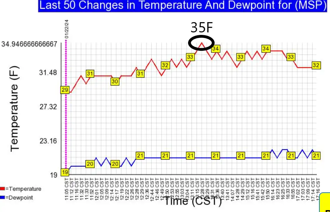
A mild surge of Pacific air gushed into southern Minnesota Monday. Temperatures at Minneapolis-St. Paul International Airport topped out at 35 degrees Monday afternoon. That’s 14 degrees above the normal high of 23 degrees for Jan. 22.
Get used to the milder air because it will last for the next one to two weeks. Highs by Sunday could approach 40 degrees across parts of Minnesota. I think the forecast high-temperature map below could be conservative by Sunday.

Upside-down snow pattern
The storm track has been unusually far south this winter. A series of heavy storms have dumped big snow from southeastern South Dakota, through Iowa, into northern Illinois and southern Wisconsin.
There’s very little snow on the ground north of Minnesota in southern Ontario and Manitoba. What little snow we have in the Twin Cities will fade fast this week.
Support Local News
When breaking news happens, MPR News provides the context you need. Help us meet the significant demands of these newsgathering efforts.

I wrote about our supersized January thaw earlier Monday. The upper-air pattern continues to show temperatures could run 10 to 25 degrees warmer than normal this week.
There are some signs of a cool-down emerging early next week. But the National Oceanic and Atmospheric Administration’s eight to 14-day outlooks strongly favor extended warmer than normal temperatures.

This looks like it may end up as one of the top 3 warmest winters on record in Minnesota. It all may depend on how February temperatures trend the last two weeks of February.
Stay tuned.