Brief cooldown Saturday before record heat Sunday
Critical fire weather threat across the state

Go Deeper.
Create an account or log in to save stories.
Like this?
Thanks for liking this story! We have added it to a list of your favorite stories.
A slight dip in temperatures Saturday before a summer-like heat wave arrives Sunday. Record setting temperatures are possible on Sunday. The combination of heat, low humidity, and gusty winds will also heighten the risk of critical fire weather across the region.
Slight reprieve on Saturday
Temperatures will briefly cool off on Saturday following Friday’s cold front. While the region remains about 10 degrees above average, the forecast will shift to the 70s after a warm Friday with highs in the 80s and 90s.

Despite the slightly cooler temperatures, northwestern Minnesota is under a red flag warning from 11 a.m. to 9 p.m. due to low relative humidity and increasing winds.
Turn Up Your Support
MPR News helps you turn down the noise and build shared understanding. Turn up your support for this public resource and keep trusted journalism accessible to all.
Southerly winds will strengthen across the western and northwestern parts of the state.

Record warmth and fire weather for Sunday
Summer-like temperatures will make a comeback from Sunday through mid-week, with record-high temperatures possible. The Twin Cities could break their record of 88 degrees set in 1900, while St. Cloud may surpass its 90 degree record from 1911. Forecasted highs are expected to reach the upper 80s to low 90s.

Winds will be a concern on Sunday, increasing and becoming quite blustery out of the south at 15-25 mph, with gusts reaching over 30 mph, and potentially 40 mph in western Minnesota.

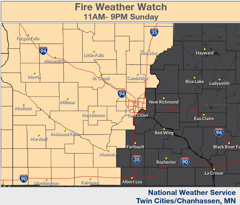
Low relative humidity, strong winds, and warm temperatures will create critical fire weather conditions from Sunday through Tuesday. A fire weather watch is in effect from Sunday morning through Sunday evening.


