

Cold front brings breezy north winds for Sunday night; cool and brisk on Monday
Seasonal temperatures return on Tuesday
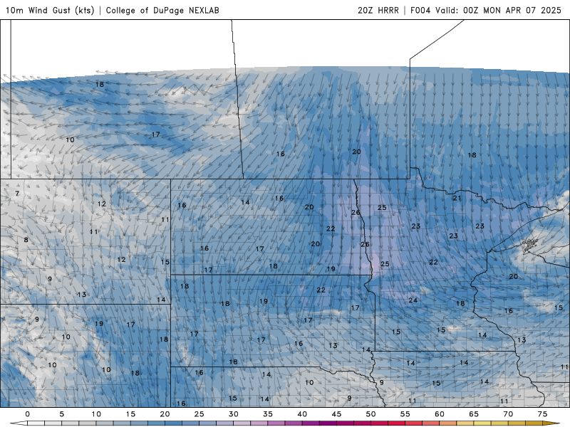
Wind speed and direction Sunday 7 p.m. until Monday 7 a.m.
NOAA via College of DuPage Weather
Go Deeper.
Create an account or log in to save stories.
Like this?
Thanks for liking this story! We have added it to a list of your favorite stories.