

Brutally cold air and clear skies ahead
Sub-zero temperatures continue through Martin Luther King Jr. Day
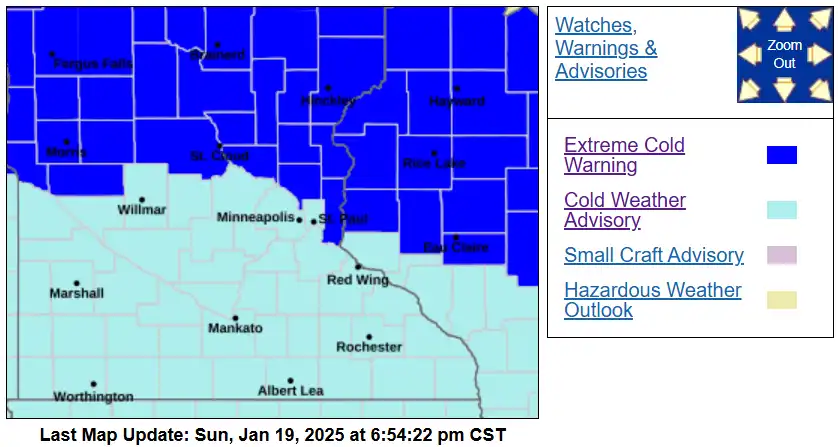
Extreme cold warning and cold weather advisory
National Weather Service
Go Deeper.
Create an account or log in to save stories.
Like this?
Thanks for liking this story! We have added it to a list of your favorite stories.