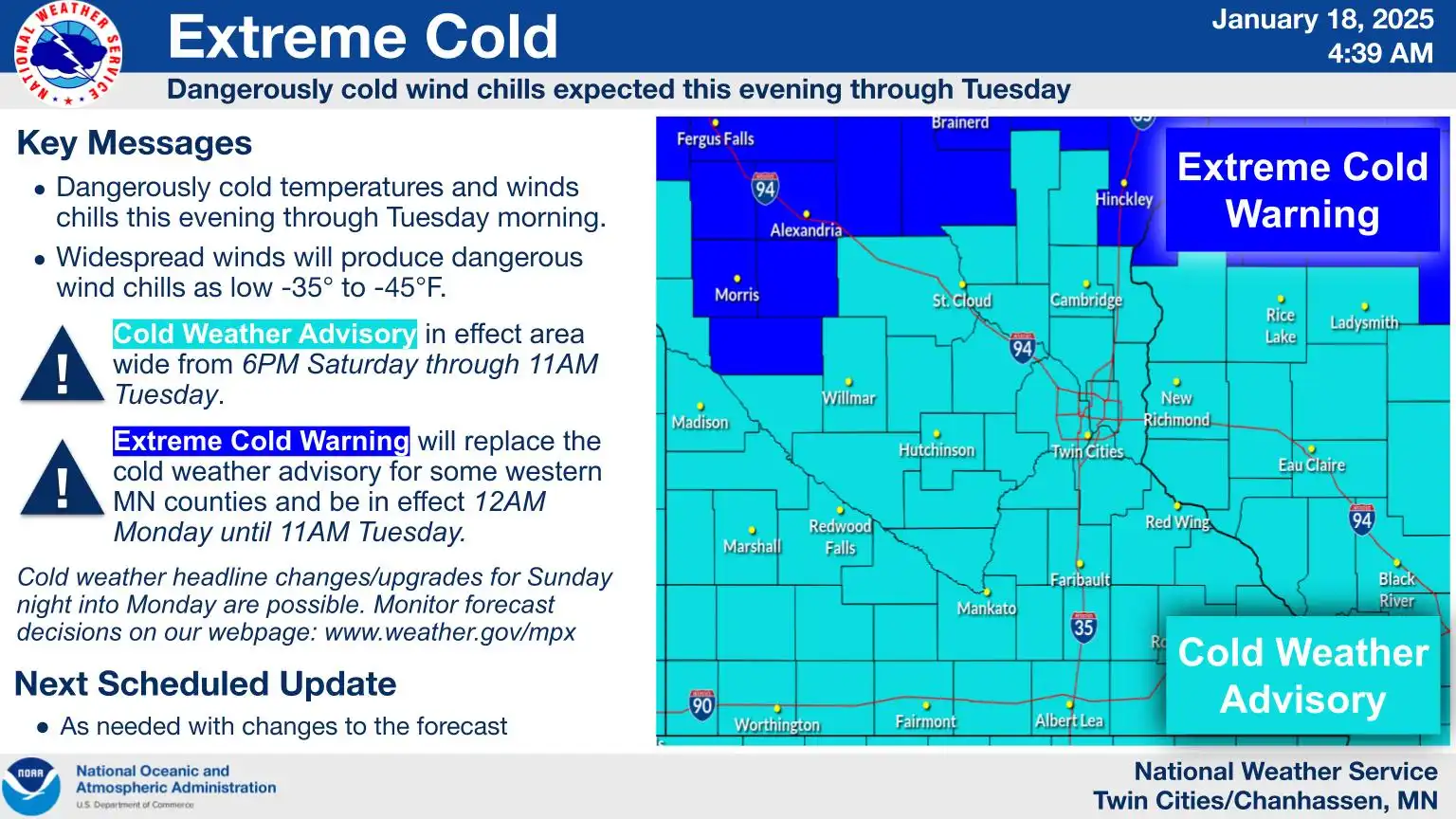
Arctic air arrives with dangerously cold wind chills this weekend
Wind chills between 30 and 40 below expected.
Go Deeper.
Create an account or log in to save stories.
Like this?
Thanks for liking this story! We have added it to a list of your favorite stories.
The coldest air mass of the season has settled in, with temperatures remaining steady in the single digits above zero for Saturday. Dangerously cold wind chills will persist, ranging from 30 to 40 degrees below zero through Tuesday.
Cold weather advisories and extreme cold warnings
With how cold our current air mass is, cold weather advisories and extreme cold warnings have been issued across the state.
We can expect wind chills between 30 and 40 degrees below zero. Frostbite and hypothermia are possible during this time.
High temperatures will hold fairly steady in the single digits above zero, and below zero highs for northern Minnesota.
Low temperatures Saturday night will drop into the teens and 20s below zero with northwest winds 10-15 mph.
High temperatures will have a hard time reaching above zero on Sunday and Monday. The coldest conditions are expected from Monday evening into Tuesday morning, with metro area temperatures dropping to around 16 below, and northern regions possibly seeing lows near 30 below.
Turn Up Your Support
MPR News helps you turn down the noise and build shared understanding. Turn up your support for this public resource and keep trusted journalism accessible to all.