

Flood watch for most of Minnesota into Wednesday
Bouts of severe storms are also possible
Go Deeper.
Create an account or log in to save stories.
Like this?
Thanks for liking this story! We have added it to a list of your favorite stories.
Multiple rounds of rain and thunderstorms will add up to several inches of potential rainfall on top of already-saturated ground. Severe weather is also possible Monday and Tuesday.
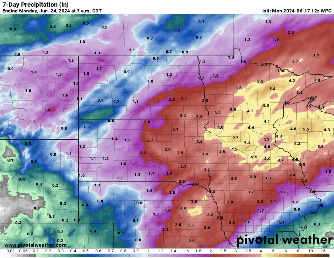
Heavy rainfall with active pattern continuing
There’s a flood watch in effect through 1 a.m. Wednesday due to additional heavy rainfall for much of Minnesota (shaded green).

After a wet morning, showers and thunderstorms will become more scattered and start to lift north. There will be additional scattered storms redeveloping later this afternoon and evening in southern Minnesota.

In addition to the flooding potential there’s a risk of severe storms with the late day activity in southern and western Minnesota. There’s a slight risk (level 2 of 5) for severe storms.
Turn Up Your Support
MPR News helps you turn down the noise and build shared understanding. Turn up your support for this public resource and keep trusted journalism accessible to all.

Most shower and thunderstorm activity Monday night into early Tuesday will be in northern Minnesota. As the cold front pushes east, combined with peak heating of the day in the late afternoon, storms will redevelop in a line and sweep across central and eastern Minnesota.

Humid and hot air will move back north for Tuesday. Dew points will climb back into the 60s and 70s setting us up for more storms Tuesday.

Highs Tuesday will be in the upper 80s to near 90 degrees in southern Minnesota.

There’s also a risk of severe storms Tuesday as a cold front touches off more storms late in the afternoon and evening. There’s a slight risk (level 2 of 5) of severe weather for much of Minnesota late Tuesday.

There will be additional rain chances mid to late week. In total, 6 inches of rain is possible on top of rainfall already received over the weekend in some spots.
Not only will there be the flooding concern over the next 24 to 48 hours but with the additional rainfall, we’ll have to watch rising river levels this week also.