

Frigid Wednesday followed by yet another record warmup
Wind chills Wednesday morning will be below zero statewide
Go Deeper.
Create an account or log in to save stories.
Like this?
Thanks for liking this story! We have added it to a list of your favorite stories.
Updated 9 a.m.
Wednesday will bring a rare, colder-than-normal day to the state. Subzero wind chills will dominate through the morning Wednesday before we rapidly warm up again Thursday.
Brief cold followed by more record warmth
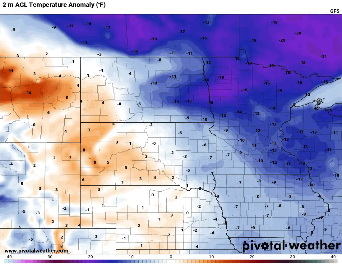
It’s a rare day of below-normal temperatures Wednesday. Temperatures are 20 to 40 degrees colder than just 24 hours ago!

We picked up some fresh snow in many parts of Minnesota Tuesday as the cold blew in. The heaviest totals were in northwestern Minnesota and the Red River Valley where many areas saw more than 6 inches, combined with 40 to 50 mph wind gusts, creating blizzard conditions.
In the Twin Cities we officially received just one-tenth of an inch. The Rochester area saw a little more with an inch to 1.5 inches of accumulation.
Turn Up Your Support
MPR News helps you turn down the noise and build shared understanding. Turn up your support for this public resource and keep trusted journalism accessible to all.

Highs Wednesday will range from just the low 20s in the south to frigid single digits in the north.

Wind chill values will be below zero all morning before recovering in the afternoon. We’ll also have some sunshine with mixed with a few clouds to make it less painful. The breeze will remain blustery at 10-20 mph from the north-northwest through the day Wednesday.
Overnight temperatures will be chilly but not as cold as Tuesday night.

On Thursday, we’ll already be warming back up to above normal, mild readings; 50s will return to southwestern Minnesota. Look for more sunshine though northern Minnesota will see more clouds.

We’re on track for more record high temperatures both Saturday and Sunday with 60s and even low 70s potentially in southern Minnesota.

The next system will generate just enough energy to produce some thunderstorms late Sunday. Rain and snow will also be possible for the region Monday night into Tuesday as colder air blows back in.
