

Rain coverage expands today, lingers into Christmas Day; wintry mix Mon. in western Minn.
Record warmth
Go Deeper.
Create an account or log in to save stories.
Like this?
Thanks for liking this story! We have added it to a list of your favorite stories.
Record highs for Dec. 24 were broken before sunrise today in the Twin Cities, St. Cloud and Eau Claire, Wisconsin.
The previous Twin Cities record high for today was 46 degrees, St. Cloud’s previous record was 44 degrees and the previous record high for this date was 45 degrees in Eau Claire. Many other locations will break records today.
Highs today will reach the 50s in roughly the southern half of Minnesota plus much of western Wisconsin:

Northern Minnesota will see mainly 40s.
Support Local News
When breaking news happens, MPR News provides the context you need. Help us meet the significant demands of these newsgathering efforts.
For reference, the average Twin Cities high temp is just 26 degrees on Dec. 24.
High temps on Christmas Day will range from upper 20s in far northwestern Minnesota to lower 50s in the southeast:

You can hear updated weather information for Minnesota and western Wisconsin on the MPR News network.
Rain in many areas, mix or snow west
Low pressure systems will bring precipitation to us today through Monday. The first batch is mainly rain today for much of Minnesota and western Wisconsin, but northwestern Minnesota and parts of west-central Minnesota will see a wintry mix.
Much of Minnesota has rain at mid-morning. Eastern portions of the Twin Cities metro area plus southeastern Minnesota and west-central Wisconsin have low rain chances through early Sunday afternoon, followed by higher rain chances later this afternoon and this evening.
Periods of rain are likely in much of Minnesota Sunday night into Monday, with snow or a wintry mix in portions of western Minnesota and far northern Minnesota.
The National Oceanic and Atmospheric Administration’s North American Mesoscale Forecast System model shows the potential precipitation pattern from noon Sunday through 5 p.m. Monday:

NOAA’s Finite Volume Cubed Sphere (FV3) model shows a somewhat similar precipitation pattern for that time period:

Patchy slick roads are possible in northwestern Minnesota today and anywhere in western Minnesota on Christmas Day:

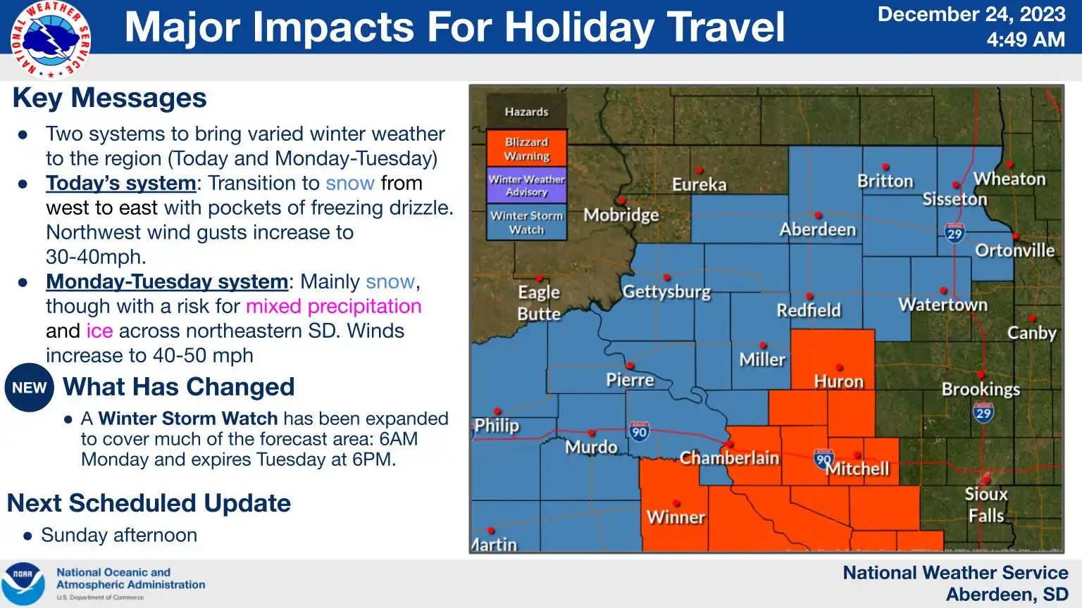
Travelers to South Dakota should be aware of blizzard warnings and winter storm watches for Monday and Tuesday:
Updated forecast info will be posted by the NWS offices in the Twin Cities, Duluth, La Crosse, Sioux Falls and Grand Forks.
Programming note
You can hear my live weather updates on MPR News at 7:35 a.m., 9:35 a.m. and 4:39 p.m. each Saturday and Sunday.