

Warm, humid Saturday; scattered showers, thunderstorms possible
Another warm day on Sunday
Go Deeper.
Create an account or log in to save stories.
Like this?
Thanks for liking this story! We have added it to a list of your favorite stories.
We’re starting our Saturday with unusually mild temps. Afternoon highs will be well above normal.
The average Twin Cities low temp is 56 degrees on June 3 and the average high temp is 75. This morning’s low temp at Minneapolis-St. Paul International Airport was 68 degrees and the afternoon high could touch 90.
Much of Minnesota and western Wisconsin will have Saturday highs in the upper 80s to around 90:

There will be some 70s near Lake Superior, with a few spots up there topping out in the upper 60s.
Turn Up Your Support
MPR News helps you turn down the noise and build shared understanding. Turn up your support for this public resource and keep trusted journalism accessible to all.
Dew points in the sticky 60s will linger through Saturday:

Sunday highs will reach the lower 90s in the roughly the southern half of Minnesota plus the far northwestern corner of Minnesota:

Mainly 80s are expected elsewhere in Minnesota on Sunday, with some 70s near Lake Superior.
Dew points will retreat slightly on Sunday.
Rain chances
An isolated shower or thunderstorm is possible Saturday morning in Minnesota and western Wisconsin.
With the heating of the day, scattered showers and thunderstorms are expected to develop over Minnesota and western Wisconsin. The scattered afternoon showers and thunderstorms could then linger into Saturday evening in some areas.
Some spots in Minnesota and western Wisconsin will see little or no rain, while other spots could see downpours at times. Remember that it does not have to be raining at your location for lightning to strike nearby.
You can find updated weather information for Minnesota and western Wisconsin on the MPR News network. Find the latest radar here.
You can check these National Weather Service sites for updated weather info: Twin Cities, Duluth, La Crosse, Wis., Sioux Falls, S.D., Grand Forks, N.D.
The NWS Storm Prediction Center has Minnesota and Wisconsin in their general (not severe) thunderstorm category Saturday and Saturday night:
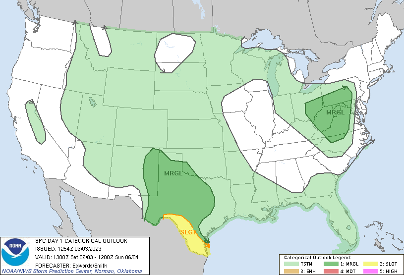
Here are the categories that are used in the Storm Prediction Center’s outlooks:

A few very scattered showers and an isolated thunderstorm could pop up over Minnesota and western Wisconsin Sunday afternoon and evening.
Update
A new Updraft will be posted around 10:30 a.m. today. It’ll include a look at the week ahead.
Programming note
You can hear my live weather updates on MPR News at 7:35 a.m., 9:35 a.m. and 4:39 p.m. each Saturday and Sunday.