A very warm week on its way; Scattered thunderstorms most days
Go Deeper.
Create an account or log in to save stories.
Like this?
Thanks for liking this story! We have added it to a list of your favorite stories.
Memorial weekend has been great for outings to lakes and parks or just hanging out in the neighborhood. That’s quite an improvement over last year. Memorial weekend 2022 brought thunderstorms to the Twin Cities on all three days. It culminated on Memorial Day in a major severe weather outbreak statewide with tornadoes, large hail and damaging winds.
A few widely scattered showers and thunderstorms have popped up during Monday afternoon. Radar has been picking them up over southwestern Minnesota moving northeast and over northwestern Minnesota tracking northward:

A marginal (level 1 of 5) risk of severe weather remains in effect this evening and tonight from the Dakotas into parts of the western edge of Minnesota.

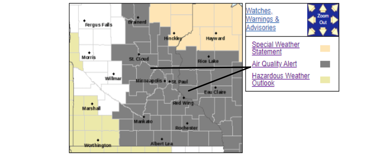
Air quality alerts into the evening
Turn Up Your Support
MPR News helps you turn down the noise and build shared understanding. Turn up your support for this public resource and keep trusted journalism accessible to all.
Otherwise, air quality alerts for ground-level ozone will continue into Monday evening for parts of eastern Minnesota and western and southern Wisconsin.

Red flag warning posted into the evening
And a red flag warning has been posted into Monday evening for much St. Louis, Cook and Lake counties of northeastern Minnesota where gusty south winds, warm temperatures and low humidities could allow fires to spread rapidly.

Change to a much more active weather pattern
Looking ahead, those showers and thunderstorms that out broke in the western half of Minnesota Monday afternoon are the leading edge of a change in our weather pattern. We’ll go from warm and dry to hot and more humid with scattered showers and storms most days this coming week as a series of disturbances advances slowly from the Dakotas across Minnesota and Wisconsin.
Showers and thunderstorms could wet the Twin Cities area Monday night. The best chance would be late in the night when a fresh batch revs up toward daybreak on Tuesday.
Hot weather with a bit more humidity, and thunderstorms, coming this week
Look for lots of high temperatures mainly in the 80s to low 90s, but cooler near Lake Superior, this coming week. The Twin Cities area is likely to warm into the upper 80s to some low 90s every day through next Sunday.

Lawns, gardens and farm fields have been drying out. Periods of rain would be welcome for most of us. It does look as though a series of loosely-organized weather systems will bring periods of scattered showers and thunderstorms throughout the week.
The strongest round of storms is likely to come our way later in the day on Tuesday. The Storm Prediction Center has posted a marginal risk of severe weather for a large chunk of Minnesota from Grand Rapids in the north down through Brainerd, St. Cloud, the Twin Cities, Redwood Falls, Mankato and Fairmont.

As the week goes on, the significant heating of the day will likely provide the energy to pop some storms mainly late each afternoon and evening. Severe storms don’t seem very likely from Wednesday on into next weekend.
How much rain will fall?
Showers and storms will be so scattered that some parts of the state will get missed on most days. Other parts might get soaked repeatedly. When it’s all added up however, the Weather Prediction Center’s forecast for the next five days ending at 7 p.m. on Saturday indicates that some areas, mainly across central Minnesota, could pick up well over an inch of rain.


