Warm, dry, summery forecast
Little or no rain for much of Minnesota for the next week

Go Deeper.
Create an account or log in to save stories.
Like this?
Thanks for liking this story! We have added it to a list of your favorite stories.
Here comes summer — well, at least meteorological summer.
Meteorological summer kicks off on June 1. But our weather maps next week look more like July.
A persistent ridge of warm, dry high pressure will build over Minnesota for at least the next week. That pattern will produce sunny and unseasonably warm days with little or no rain for most of Minnesota.
And we’re getting a little dry out there in many locations.
Turn Up Your Support
MPR News helps you turn down the noise and build shared understanding. Turn up your support for this public resource and keep trusted journalism accessible to all.
Temperatures will begin to warm through the upcoming holiday weekend.
Highs Friday will warm into the 80s again across most of western and northern Minnesota except near the North Shore.

By Sunday, most of Minnesota will be basking in the 80s.

Let’s look at the upper-air pattern next week. The Northern Hemisphere upper-air forecast for next Thursday features a broad bubble of warm-colored high pressure across the central United States into Canada.

This pattern produces unseasonably warm weather for the Upper Midwest. Our average high and low temperatures for the Twin Cities next week are 74 and 55 degrees. But we’ll be baking in the upper 80s, with a shot at 90 degrees in much of Minnesota next week.

Trending dry again
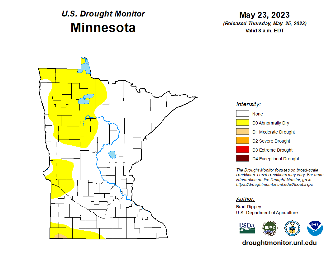
Rainfall has been scarce the past few days across most of Minnesota. Soils and streams are already trending dry across western Minnesota. Thursday’s latest U.S. Drought Monitor shows 30 percent of Minnesota is now abnormally dry.

The rainfall outlook favors persistent dryness for much of Minnesota.
The National Oceanic and Atmospheric Administration’s Global Forecast System model is typical of many that show little or no significant rain likely in the next 10 days across the southern half of Minnesota.
The northern half of Minnesota stands a better chance of a soaking inch or two. Here’s NOAA’s GFS model precipitation output for the next 10 days:

So we may be easing into drought in some areas in the next couple of weeks. It remains to be seen if June will deliver normal rainfall later in the month.
Stay tuned.


