Air quality alert Tuesday afternoon; showers, thunder north; very warm south
Warm, bright Memorial Day weekend ahead

Go Deeper.
Create an account or log in to save stories.
Like this?
Thanks for liking this story! We have added it to a list of your favorite stories.
An air quality alert is in effect from noon through 8 p.m. Tuesday for central and southern Minnesota. Northern Minnesota should expect scattered showers and thunder. It’ll be warm south.
Smoke and ozone Tuesday
Here’s the map for the air quality alert posted for central and southern Minnesota starting at noon Tuesday:

The pollutants Tuesday come in the form of ground-level ozone which happens as a result of auto and industrial pollution reacting with heat and sunlight.

The sky is hazy however as a result of the wildfire smoke from Canada. So we have both issues: smoke aloft and ozone near the surface.
Turn Up Your Support
MPR News helps you turn down the noise and build shared understanding. Turn up your support for this public resource and keep trusted journalism accessible to all.

You can find current air quality conditions here:
Here are air quality forecasts for the next couple of days also:
Front to deliver thunder north, cooler air
We have a very warm day Tuesday with widespread highs in the 80s ahead of cooler air.

A cool front is sliding south across northern Minnesota touching off a scattered line of showers and thunder, especially filling in more this afternoon and evening Tuesday. The activity will largely fizzle out to just an isolated shower or two overnight Tuesday night.

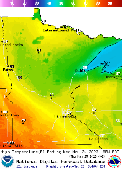
Behind the front it will be cooler for most of northern and eastern Minnesota Wednesday. Western Minnesota will still be near 80 degrees, however, while most in the east drop 10 to 15 degrees.

Wednesday night will be downright chilly for many spots, especially north with lows in the 30s in northeastern Minnesota and 40s and 50s south.

Memorial Day weekend: Largely warm, dry
A persistent upper-level ridge of high pressure continues to create a dome of warmer-than-normal conditions and dry weather.
Occasionally some disturbances are able to break through this ridge or around it but this feature will dominate Minnesota weather over the upcoming holiday weekend.

Scattered showers and thunderstorms will remain mostly west of Minnesota into Memorial Day. A few thunderstorms could ride through the ridge with the best chances being in western Minnesota.

Conditions look to heat up more next week with continued above-normal temperatures and below-normal precipitation. Some models even hint at 90 degrees.


