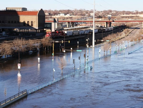
As river rises, St. Paul to close stretch of Shepard/Warner Road

Go Deeper.
Create an account or log in to save stories.
Like this?
Thanks for liking this story! We have added it to a list of your favorite stories.
The city of St. Paul plans to temporarily close a stretch of Shepard/Warner Road on Sunday, as the adjacent Mississippi River threatens to flood the route to and from downtown.
The route will be closed to vehicle, pedestrian and bicycle traffic starting at 6 p.m. Sunday, between Eagle Parkway and Highway 61 — a stretch of just over 3 miles.
That closure will also force traffic changes along Sibley and Jackson streets between Second Street and Kellogg Boulevard in downtown St. Paul.
The Mississippi River is forecast to reach major flood stage — 17 feet — at St. Paul around the middle of next week, and rise to a level of about 18.3 feet by the end of the week.
Turn Up Your Support
MPR News helps you turn down the noise and build shared understanding. Turn up your support for this public resource and keep trusted journalism accessible to all.
The same stretch of Shepard and Warner roads was closed for nearly seven weeks when the Mississippi River flooded in 2019, and covered parts of the roadway. The river crest that year was 20.19 feet.
The city of St. Paul already has temporarily closed Water Street / Lilydale Road between Highway 13 and Plato Boulevard. The Pool and Yacht Club and Harriet Island will remain open and accessible for now.
Some other parks and trails along the river also have been temporarily closed, including all or part of Hidden Falls Regional Park, Crosby Farm Regional Park, Lilydale Regional Park and Raspberry Island.
Find updated closure information on the city's website.
High water and river flooding also has prompted the closure of some local, county and state roads across Minnesota.
For information on state highway closures, check the Minnesota Department of Transportation’s 511 website.


