

Cold, sunny Wednesday; rain, snow, thunder Thursday into Friday
Severe storms possible in far southern Minnesota late Thursday

Go Deeper.
Create an account or log in to save stories.
Like this?
Thanks for liking this story! We have added it to a list of your favorite stories.
Expect cold sunshine Wednesday with temperatures well below normal. A complex spring storm brings rain, thunder and snow Thursday into early Saturday. Severe storms are possible in far southern Minnesota late Thursday.
Cold temperatures and sun Wednesday
It was frigid early Wednesday with lots of subzero low temperatures across northern and western Minnesota in the wake of Tuesday’s clipper system, which brought an inch or so of snow to some places.

High pressure parked in the region Wednesday will keep things mostly sunny.

Temperatures will be well below normal Wednesday with highs ranging from the upper teens in the northwest to around 30 in southeastern Minnesota.
Turn Up Your Support
MPR News helps you turn down the noise and build shared understanding. Turn up your support for this public resource and keep trusted journalism accessible to all.

Rain, snow, freezing temps in Thursday storm
Rain and snow showers and possibly freezing rain develops Thursday afternoon into Thursday night with thunderstorms even in southern Minnesota.
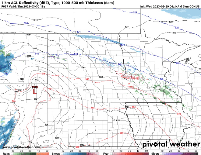
Ice accumulation will occur where temperatures remain below freezing as rain falls in north-central Minnesota.

Northern Minnesota will see snowfall Thursday night with widely variable amounts as we’ll see bands of heavy snow develop.

There’s a general risk of thunderstorms across southern Minnesota Thursday evening and overnight. Some storms along the Minnesota, Iowa border could contain hail.

There’s also a marginal risk of severe weather along the Minnesota and Iowa border Friday with a greater risk south of severe storms.

Friday night is when we will see snow fall across southern Minnesota as colder air works into the back side of the system.

Rain and thunder Friday afternoon will quickly turn to heavy snow.

In addition to the wintry precipitation winds will really increase late Friday with 40 to 52 mph wind gusts possible.

Most of Minnesota will see at least some snowfall Thursday into Saturday.

Temperatures will then warm to near 50 degrees by Sunday and Monday making the fresh snow short-lived.