

Sunday sunshine, with reasonable afternoon temps
Lighter winds than yesterday
Go Deeper.
Create an account or log in to save stories.
Like this?
Thanks for liking this story! We have added it to a list of your favorite stories.
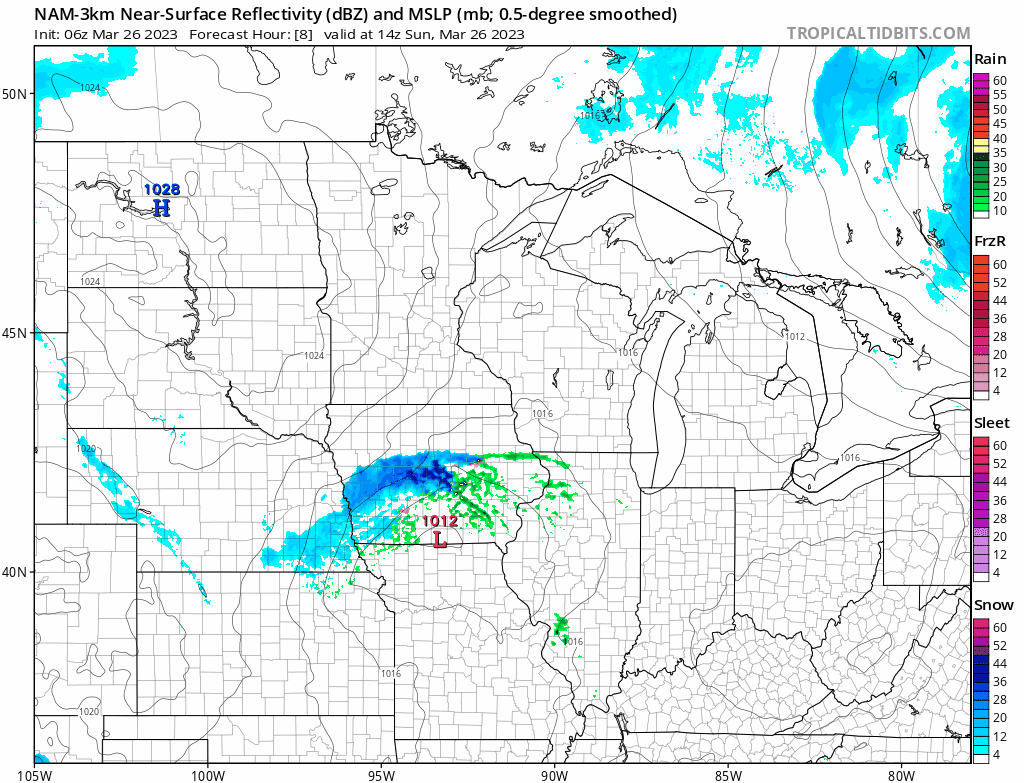
A high pressure system over the Dakotas will give us northwesterly breezes and plenty of sunshine today.
I’m not expecting any organized rain or snow in Minnesota or west-central Wisconsin between now and sunset.
The National Oceanic and Atmospheric Administration’s North American Mesoscale (NAM) forecast model shows the potential precipitation pattern from 9 a.m. to 10 p.m. today:
You can find updated weather information for Minnesota and western Wisconsin on the MPR News network, and on the MPR News live weather blog.
Turn Up Your Support
MPR News helps you turn down the noise and build shared understanding. Turn up your support for this public resource and keep trusted journalism accessible to all.
Sunday highs
Our average March 26 high temperature is 47 degrees in the Twin Cities. Metro area highs are forecast to reach the lower 40s Sunday afternoon.
Sunday highs will be in the 20s in far western Minnesota, with 30s from central Minnesota into northeastern Minnesota.
The Twin Cities metro area, southeastern Minnesota and most of western Wisconsin will see highs in the 40s:

Snow depths
Much of Minnesota still has plenty of snow cover for cross-country skiing and sledding.
Here’s the latest Minnesota snow depth map from the Minnesota State Climatology Office:

There has been some melting of the snow pack since Thursday, but areas that had the most snow cover on Thursday are likely to still have plenty of snow on the ground.
Most of the northern half of Minnesota reported snow depths of 18 inches or higher on Thursday, with snow depths of 30 inches or higher in much of northeastern Minnesota.
Twin Cities metro area snow depths varied from 12 inches or higher in the north metro to around 4 inches in parts of the southwest metro. I notice on today’s climate report that the National Weather Service has 8 inches of snow cover at their office in Chanhassen. MSP airport has just one inch of snow on the ground.
There’s little or no snow cover in much of southeastern Minnesota and in parts of far south-central Minnesota.
Update
A new Updraft will be posted around 10:20 a.m. today. It will include a look at the week ahead.
Weather nugget
On this date in 2012, a new record earliest ice-out date was set for Mille Lacs Lake.
Programming note
You can hear my live weather updates on MPR News at 7:35 a.m., 9:35 a.m. and 4:39 p.m. Saturday and Sunday.