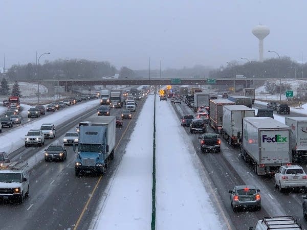
Record snow Friday? Swaths of southern Minnesota may see 12+ inches
Next week trends much drier and milder

Go Deeper.
Create an account or log in to save stories.
Like this?
Thanks for liking this story! We have added it to a list of your favorite stories.
Updated 9:50 a.m.
A complex weather system is moving heavy snow into southern Minnesota Friday, forcing numerous closures and deteriorating travel conditions.
Snowfall totals will crush the Twin Cities’ current Dec. 10 record of 2 inches and may eclipse the statewide record of 14.2 inches for this date.
Sunshine returns just in time for the weekend.
Friday’s storm
The major snowstorm we have been watching all week has finally begun to arrive, delivering a few light snow showers to southern Minnesota as of 9:30 a.m., including a band north of Interstate 90.

This is part of a major storm complex that passes well south of Minnesota Friday. It has trended stronger than earlier forecasts and is poised to funnel Gulf of Mexico moisture north. The combination of it being a stronger, wetter storm is why forecast snowfall totals have increased over the past couple days.
Turn Up Your Support
MPR News helps you turn down the noise and build shared understanding. Turn up your support for this public resource and keep trusted journalism accessible to all.
Minnesota is on the colder side of the storm, meaning heavy snow at times, but the system is potent enough there is even a slight chance for thundersnow Friday evening.
Light snow continues to spread through southern Minnesota through the morning, with more persistent snow from about St. Cloud south by the afternoon.
Southern Minnesota can expect the heaviest snow, especially in the afternoon and evening hours.

Even the Twin Cities will see occasionally heavy bands (times where snowfall totals 2 inches or more in an hour) in the late afternoon and evening hours, particularly in the south and east metro.
Expected snowfall totals rapidly diminish north of the Twin Cities, with much of central and northern Minnesota too far north to be affected by the storm.
Even across the Twin Cities region, snow totals will vary greatly, with the northern edge seeing 5 to 6 inches while southeastern areas could see some isolated reports near a foot.

Because of the significant travel impacts expected, most of southern Minnesota is under a winter storm warning through Saturday morning, with a winter weather advisory on the northern fringe of the storm where snow totals start to taper off.

Snowfall diminishes overnight and moves out of the state by Saturday morning.
Meanwhile, temperatures Friday will be in the 20s north and low 30s south.

The storm center will be far enough to the south for Minnesota to escape most of the major wind impacts, but it will be somewhat breezy in southern Minnesota, with gusts in the teens for the Twin Cities and over 20 mph south.
Those gusts are well shy of the winds needed for blizzard conditions, but some areas of blowing snow are still possible in southern Minnesota as the storm exits Saturday morning.
Extended forecast
Friday caps what has been a very active weather week across Minnesota. The week included last weekend’s storm which brought both areas of heavy snow north, but also high winds Monday and frigid cold through Tuesday. Persistent light snow also snarled traffic Tuesday for portions of central and southern Minnesota, including the Twin Cities. Another round of lighter snow moved through eastern Minnesota early Thursday.
That active pattern finally turns quieter once Friday’s snowstorm clears out early Saturday. Already by Saturday afternoon, more sunshine returns and the remainder of the weekend stays mostly sunny.

Drier weather is likely through at least the middle of next week, at which point temperatures will be mild enough that any precipitation could include a rain and snow mix.
Those temperatures start off seasonably cold Saturday with 20s north and low 30s south, but bounce back above average quickly, with most of Minnesota in the 30s Sunday. Ahead of the rain and snow potential Wednesday and Thursday, Wednesday temperatures could even make it into the 50s in southern Minnesota.
Programming note
You can hear my live weather updates on Minnesota Public Radio at 7:49 a.m. Monday through Friday morning.


