

Worst air quality on record Thursday in Minnesota
Air quality monitors record highest readings ever in St. Cloud
Go Deeper.
Create an account or log in to save stories.
Like this?
Thanks for liking this story! We have added it to a list of your favorite stories.
Another week, another poor air quality record.

Air quality monitors in Minnesota recorded the highest particulate readings on record Thursday, according to data from the Minnesota Pollution Control Agency. Most MPCA monitors came online in 2000.
The air quality monitor at St. Cloud hit an astounding 422 micrograms per cubic meter at 11 a.m. Thursday.
The St. Cloud reading breaks the record set a couple of hours earlier at Brainerd of 401 micrograms per cubic meter. Both readings broke the record set in last week’s smoke event at Red Lake of 397 micrograms per cubic meter.
Turn Up Your Support
MPR News helps you turn down the noise and build shared understanding. Turn up your support for this public resource and keep trusted journalism accessible to all.
Here’s more from my email exchange with Nick Withcraft at MPCA Thursday:
Hi Paul,
We initially set a new high at Brainerd (401 ug) , then a couple hours later we set another new high at St Cloud (422ug)! These are the 1 hour readings at our monitors as reported on the Airnow website. We set 2 record highs in one day!
Thanks,
Nick
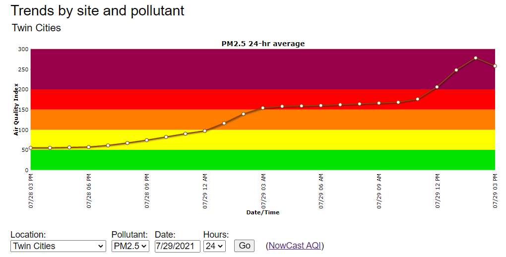
Air quality in the Twin Cities peaked in the very unhealthy range Thursday.
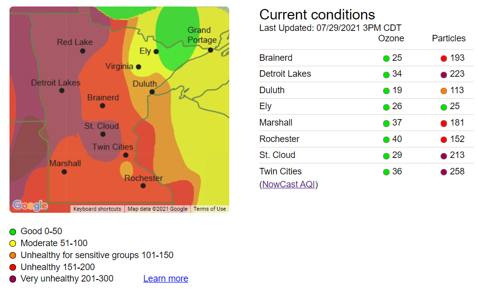
Air quality readings across much of Minnesota remained in the unhealthy to very unhealthy range Thursday afternoon. The highest readings favored the western half of Minnesota.
Visible from space
The thick smoke plume over Minnesota is clearly evident from 22,000 miles in space on NOAA’s GOES-16 weather satellites.
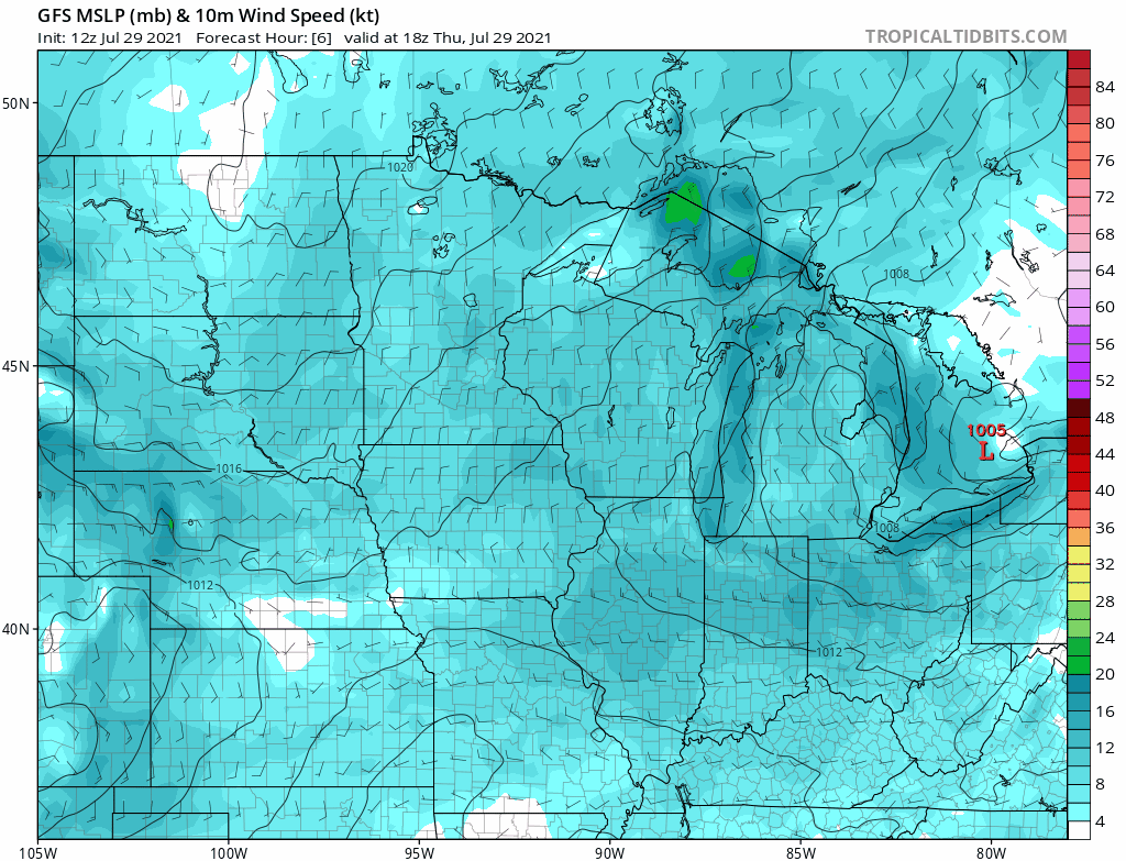
Northerly winds behind Wednesday night’s storm-producing cold front blew the smoke straight into Minnesota from Canadian wildfires to the north.
As high-pressure drifts east of Minnesota Friday, winds will shift back into the southwest. That should disperse much of the smoke by Friday afternoon. NOAA’s NAM 3 km model shows the forecast trend.
An air quality alert remains in effect until 3 p.m. Friday for most of Minnesota.
Correction (July 30, 2021): Nick Witcraft’s name was misspelled in an earlier version of this story.