Minne-snow-ta: 5 to 12 inches likely by Friday
Go Deeper.
Create an account or log in to save stories.
Like this?
Thanks for liking this story! We have added it to a list of your favorite stories.
First, extreme cold. Then the ice. Now, welcome to the snowy act of winter.
The upper air pattern over North America is set up to deliver multiple snow shots to Minnesota. I see three separate snow systems over the next week. Most of central and southern Minnesota including the Twin Cities will likely pick up 5 to 12 inches by Friday.
System #1
Welcome to another messy rush hour for commuters. Today's snowmaker centers on the Twin Cities southern Minnesota with lighter snow up north. The bulk of the snow shield favors areas from St. Cloud south to the Iowa border where any icy mix is included.
Turn Up Your Support
MPR News helps you turn down the noise and build shared understanding. Turn up your support for this public resource and keep trusted journalism accessible to all.
NOAA's NRRR model delivers snow of varying intensity before pushing east later tonight.

Snowfall totals from this first wave favor a broad zone of 2" to 4" accumulations with some locally heavier totals in excess of 6" possible south and east of the Twin Cities.

Wave #2
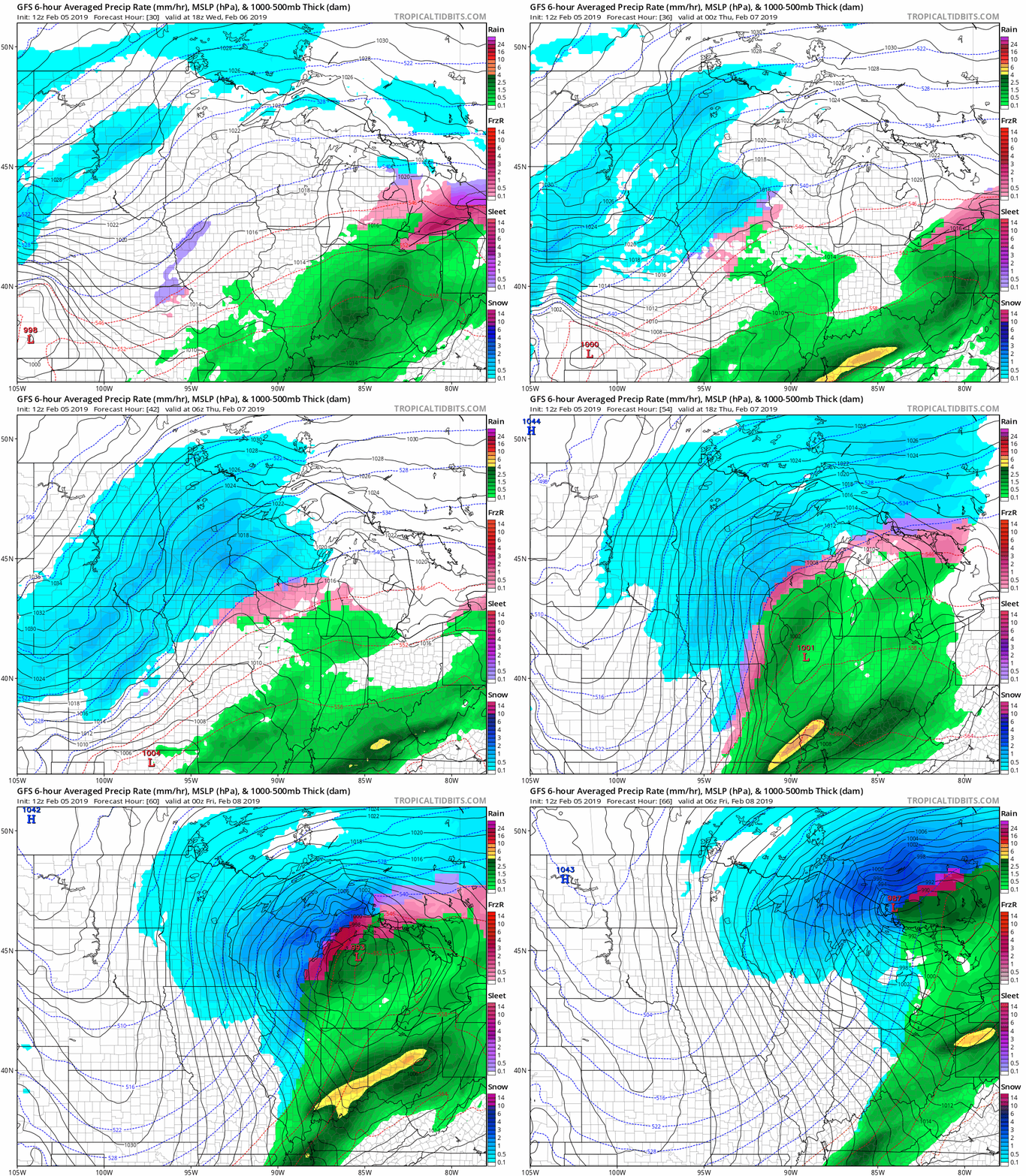
The second snow wave this week looks stronger than today's system. A wrapped up low-pressure storm will push snow into western Minnesota Wednesday afternoon. By Wednesday night, it will be snowing heavily across most of Minnesota. The snow lingers most of Thursday.
NOAA's GFS model shows the evolution of the Chicago-bound low and the snow shield.

The heaviest snow bursts likely arrive overnight Wednesday into parts of Thursday. The longer duration of this event will likely produce some 3" to 8" totals. Widespread 5" to 10"+ totals are likely across the southern half of Minnesota between the two events by Friday morning. Totals fall slightly as you move north.

Frigid weekend
The air mass behind the system Friday is cold, but nothing compared to what we endured last week. Highs rebound into the 20s (above zero) next week.

Seasonably chilly for now
Overall temperatures look to run a few degrees below average through most of next week. There are signs the upper air pattern will blow in milder Pacific air with highs in the 30s possible the weekend of February 16-17.

Milder by March?
My hunch on the way this winter evolves is that the cold will not last well into spring as it did last year.
NOAA's Climate Forecast System is cranking out warmer than average temperatures across most of North America by March. We'll see.

Stay safe and stay tuned.


