Instant January: Snow and cold now; 50-degrees by next weekend?
Go Deeper.
Create an account or log in to save stories.
Like this?
Thanks for liking this story! We have added it to a list of your favorite stories.
Happy New Year?
The high temperature at MSP Airport staggered to just 24 degrees Friday. That's perfectly average. For New Year's Day. Our instant winter continues this weekend. But a change in the upper air pattern brings milder Pacific air late next week. Is this frigid to mild weather pattern a preview of coming attractions in this El Nino winter?
Heavy North Shore snow
Heavy snow piled up close to the low-pressure center swirling over Lake Superior Friday. Grand Portage reports 13.5-inches. Grand Marais had 7-inches. Holy cow.
Turn Up Your Support
MPR News helps you turn down the noise and build shared understanding. Turn up your support for this public resource and keep trusted journalism accessible to all.
Here's an early-season shout-out to Minnesota's snow plow drivers. Give them some room to work!
Lake-effect
Downwind shores of Lake Superior are getting pounded with heavy lake-effect snow. Lake-effect can be heaviest early in the season when lake temperatures are still relatively warm. Snowfall rates of 3-inches per hour are reported.
Watch this incredible radar loop from earlier Friday. You can see the lake-enhancement along Minnesota's North Shore, and true lake-effect snow bands setting up in northwest Wisconsin.
Cold and colder
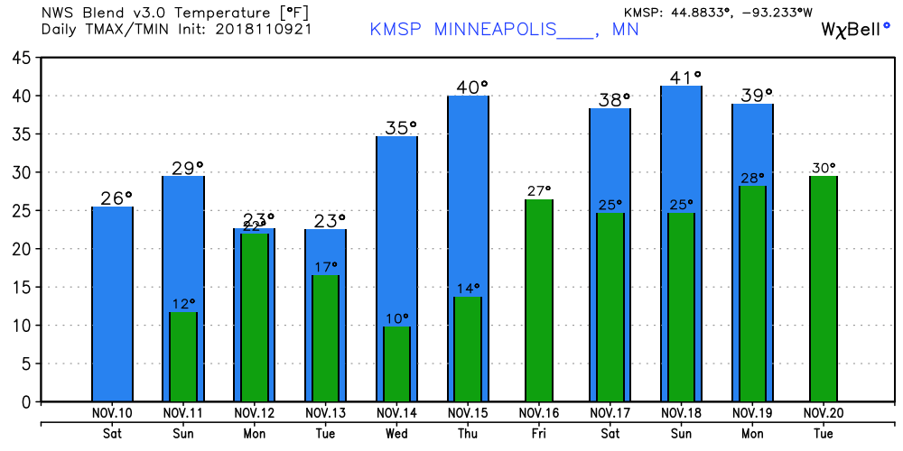
Temperatures this weekend feel more like January across the Upper Midwest. But milder Pacific air blows in starting next Wednesday. I still think 40-degrees is too conservative late next week.

Zonal flow
That's what meteorologists call west to east flowing jet stream patterns. This setup blows in milder Pacific air into Minnesota.

NOAA's GFS model still hints at 50-degrees around the weekend of November 17-18 in the Twin Cities and southern Minnesota. We'll see.


