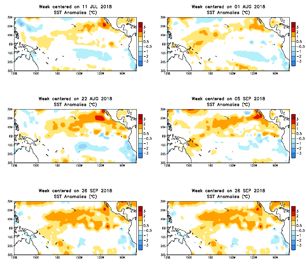
El Nino brewing: Another mild winter ahead?

Go Deeper.
Create an account or log in to save stories.
Like this?
Thanks for liking this story! We have added it to a list of your favorite stories.
You'll be hearing a lot about El Nino again in the coming months. Ocean temperatures in the tropical Pacific Ocean have warmed above average in recent weeks.

Sea surface temperatures (SST's) across a big chunk of the tropical Pacific have now reached the El Nino threshold level of +0.5C above average. The trend is there for El Nino to officially take hold in the coming weeks.
El Nino 'warning' ahead?
The National Oceanic and Atmospheric Administration's latest update posted an El Nino watch for the upcoming winter season. If sea surface temperatures continue to trend warmer, an El Nino warning is likely coming in the next update in October or November.
Turn Up Your Support
MPR News helps you turn down the noise and build shared understanding. Turn up your support for this public resource and keep trusted journalism accessible to all.
September's projection of SST's this winter suggests an El Nino event is on the way.

Mild winter ahead?
El Nino winters historically skew statistically mild across the Upper Midwest and the northern U.S.

Double whammy
It's important to remember that we still get "winter" in El Nino years. But the likelihood of warmer than average temps in winter runs about 70-percent in El Nino years. We can still get sub-zero cold waves and snow.
But this winter could deliver a mild double whammy to Minnesota. Climate change is forcing a strong background trend of warmer winters in Minnesota. Combine that with an El Nino winter, and we could see significant mild periods.
NOAA's winter outlooks already favor warmer than average conditions across the Upper Midwest and much of the nation.

It may be hard to keep solid ice on lakes and to keep consistent snow cover on the ground in Minnesota this winter.
Stay tuned.


