Smoky Skies: 63 Canadian wildfires driving smoke into Minnesota
Go Deeper.
Create an account or log in to save stories.
Like this?
Thanks for liking this story! We have added it to a list of your favorite stories.
At least 63 wildfires burning in Ontario are belching out smoke plumes that will likely drift into Minnesota at times. The Canadian Broadcast Corporation reports nearly 30 of those blazes are out of control.
Dozens of wildfires dot the map across the Canadian province that makes up Minnesota's northern border.
Smoke plumes from the fires east of Winnipeg, Manitoba near the Ontario border have been visible from space on weather satellites.
Smoky winds
Turn Up Your Support
MPR News helps you turn down the noise and build shared understanding. Turn up your support for this public resource and keep trusted journalism accessible to all.
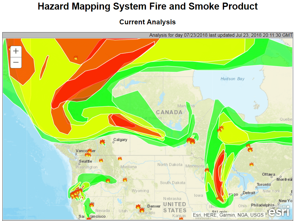
You may have noticed the whitish sky tint the past few days and some vivid reddish sunsets across Minnesota. That's produced by varying levels of smoke aloft refracting sunlight. NOAA's smoke mapping product shows massive plumes of smoke drifting across Canada and the northern U.S. The most concentrated smoke plume was over Wisconsin and northeast Illinois Monday.

Air quality moderate for now
So far smoke has not been a sustained issue at ground level across Minnesota. But many locations have reached the moderate to high level for particulate matter in the past few days.
You can see the latest MPCA air quality index values here.

Northwest flow
Our prevailing winds this week will be from the northwest overall. A cold front diving south Wednesday could severe as a focus that may bring smoke down to ground level in Minnesota. Northerly flow from Canada Thursday may also blow smoke south into Minnesota.
Here's NOAA's GFS model forecast wind flow at about 5,000 feet above ground level this week.

The bottom line for Minnesota is until the Canadian fires are doused by rain, any northerly wind flow will blow smoke into Minnesota skies this week and possibly beyond. Expect changeable smoke levels and possible air quality alerts this week in parts of Minnesota.


