

Presidents Day snow chances growing?
Go Deeper.
Create an account or log in to save stories.
Like this?
Thanks for liking this story! We have added it to a list of your favorite stories.
It's beginning to look like our next significant snowfall event could arrive on Presidents Day.
Multiple forecast model runs are winding up a low pressure system that could dump plowable snow somewhere in Minnesota Monday. It's still too early for high confidence here, but both the European and American models crank out significant snow next Monday for the Twin Cities.
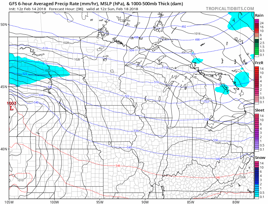
Colorado low
Let's start with the National Oceanic and Atmospheric Administration's Global Forecast System model. The GFS develops a classic Colorado low-pressure system that dives into western Kansas then tracks toward Milwaukee by way of Iowa. This scenario would spread significant (and potentially heavy) snow into Minnesota Sunday into Monday.
Turn Up Your Support
MPR News helps you turn down the noise and build shared understanding. Turn up your support for this public resource and keep trusted journalism accessible to all.
The last few runs of the European Centre for Medium-Range Weather Forecasts model also bring potentially heavy snow into the Twin Cities next Monday.

Confidence factor
Since we're still in the lower confidence zone five days out, I'll spare you the inches forecast laid out by the forecast models for now. Suffice to say this system could produce a swath of 6 to 12 inches somewhere in Minnesota if current model trends hold.
Here's my current thinking on forecast confidence for next Monday.
Confidence factor for significant snow (3"+) somewhere in Minnesota next Monday: 8 of 10
Confidence factor for significant snow (3"+) in the Twin Cities next Monday: 6 of 10
Confidence factor for heavy snowfall (6"+) in the Twin Cities next Monday: 5 of 10
So a 50/50 shot at heavy snow next Monday is worth highlighting now in my professional opinion. Heavy snow is not a slam dunk, but there's forecast value in keeping an eye on this.
Stay tuned.
Temperature roller coaster
Our long predicted Valentine's Day thaw did not disappoint. Minnesota rode the northern edge of a mild Pacific air mass Wednesday afternoon.

The thaw is short-lived. Our next cold front arrives Thursday with falling temperatures.
Temperatures rebound briefly this weekend into above average territory.

Winter is not over yet. But at least we're getting some milder interludes as we head toward March.