Cool today and Friday; mild weekend
Go Deeper.
Create an account or log in to save stories.
Like this?
Thanks for liking this story! We have added it to a list of your favorite stories.
Our average high temperature this time of year is 56 degrees in the Twin Cities. We'll top out around 50 today, but overall, this has been a mild October.
Our average temperature for October 2016 is running 4.5 degrees above normal. This is likely to be our 14th consecutive warmer than normal month in the Twin Cities!
Today's high will be cool statewide:

Lows tonight will drop into the 30s:
Turn Up Your Support
MPR News helps you turn down the noise and build shared understanding. Turn up your support for this public resource and keep trusted journalism accessible to all.

With light winds overnight, parts of the Twin Cities metro area could see frost, even if the official temp only drops into the middle 30s.
Friday's highs will be slightly below normal:

Temps rebound this weekend, with lower 60s over southern Minnesota and 50s elsewhere in our state.
Dry stretch
High pressure will sprawl across Minnesota today and tonight, then drift eastward Friday through Saturday:

We'll have several dry days, with the next good chance of rain holding off until Monday night and Tuesday.
That's great weather for finishing outdoor projects or sneaking in a late season round of golf!
Wettest 12 month period
We just experienced the wettest October 19 to October 18 period in Twin Cities history, according to the Twin Cities National Weather Service office.
From October 19, 2015 through October 18, 2016 Minneapolis-St. Paul International Airport recorded 43.37 inches of precipitation. That total includes rainfall plus the water content of our snowfalls.
The second highest precipitation total for that same period (October 19-October 18) was 41.80 inches in 2001-2002.
This graph compares precipitation for that period for each year since 1872:

In case you're wondering, our average annual precipitation total is 30.61 inches in the Twin Cities.
Mild next week?
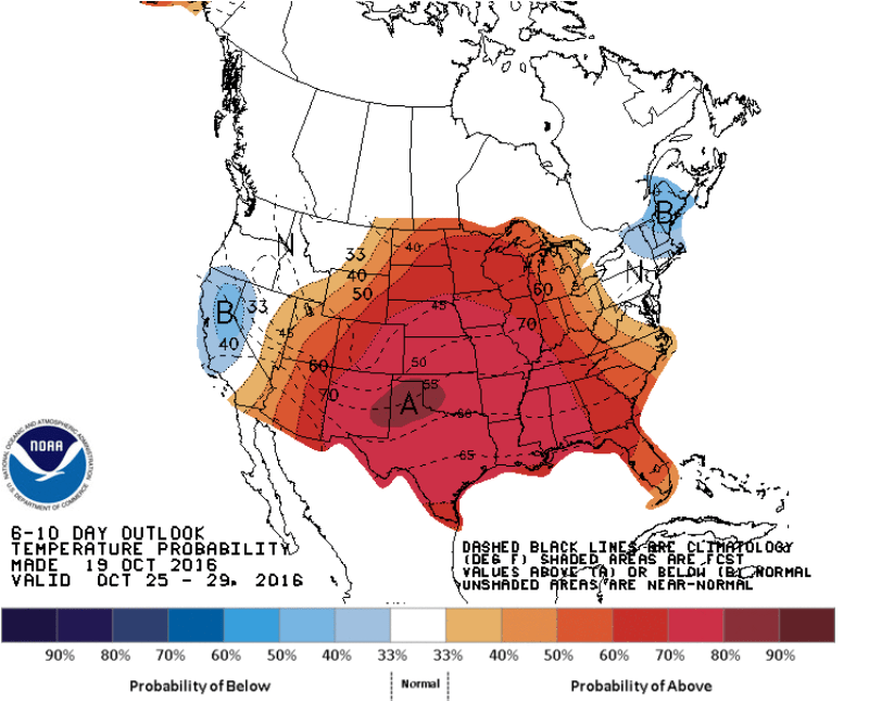
The 6 to 10 day outlook from the Climate Prediction Center of the National Weather Service shows a tendency for above normal temperatures next week:

The outlook covers the period from October 25 through October 29.
By the way, on October 29th our average high temperature is 52 degrees in the Twin Cities, so even middle 50s would be milder than normal.
And in case you are wondering, there is no snow in our immediate future!


