Spectacular 4th of July weekend forecast?
Go Deeper.
Create an account or log in to save stories.
Like this?
Thanks for liking this story! We have added it to a list of your favorite stories.
High Summer
Deep blue skies. Decorative shallow white fair weather cumulus clouds. Gentle breezes. Pleasantly warm days and comfortably cool nights. Low dew points and relatively few mosquitoes showing up on Doppler.
Yes, as I pointed out this morning we need some rain. But as for 'Minnesota Nice' weather, does it get any better than this?

The deepest part of summer now lies just ahead. July and August are the two warmest months on average in Minnesota. Soon refreshingly cool Canadian fronts may be harder to come by.
Turn Up Your Support
MPR News helps you turn down the noise and build shared understanding. Turn up your support for this public resource and keep trusted journalism accessible to all.
The 4th of July. The Minneapolis Aquatennial. The Minnesota State Fair? They're all creeping closer now on your summer Outlook calendar.
Soak. Swim. Savor. Repeat. 'High summer' has arrived in Minnesota.
Scattered t-showers drift south
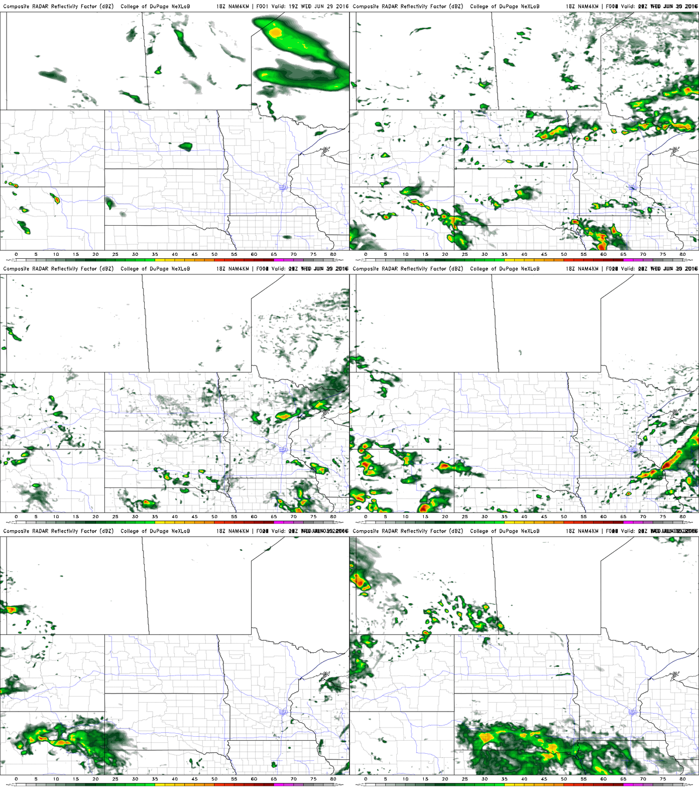
Our next Canadian cool front slides southward through Minnesota Thursday. Scattered storms rumble though northern Minnesota tonight, grazing the Twin Cities by around lunchtime Thursday. NOAA's 4 km NAM model picks up on the trend as the spotty frontal band of showers and T-Storms slides south.

Rainfall looks scant with the passing front Thursday. The Twin Cities will be lucky to pick up .25" with the passing front, The chances are your lawn will get less than that.

Free AC again Friday
The next high pressure cell from Canada features another delightful air mass packing sunny skies, fresh breezes and comfortable dew points int he 40s and 50s. Watch the maps as the big blue "H" drifts lazing over Minnesota Friday, setting the stage for what looks like an amazing run of weather for the 4th of July holiday weekend.

Holiday weather perfection?
This may be one of the best looking 4th of July forecasts in recent memory for most of Minnesota. The high pressure cell on the above maps is likely to stall and spread over Minnesota, keeping skies generally sunny and blocking any significant rainfall through the 4th of July on Monday.
The European model below picks up on Thursday's shower chances, and has come into agreement with NOAA's GFS model on the notion of a sunnier and warmer 4th of July. I still think mid 80s are likely on the 4th, with a shot at 90 later next week. C to F conversions here.

Drought watch
Aside from Thursday's shower chances, the forecast looks increasingly dry well into next week. It's nice to have a generally sunny holiday weekend, but drought is now clearly emerging on the Weather Lab Doppler. I fully expect Thursday's morning's updated U.S. Drought Monitor to show an increase in drought and dryness across western and central Minnesota where rainfall is well below average for June.

[image]
Climate Cast
On Thursday's Climate Cast on MPR News we'll talk about why climate scientists are increasingly able to attribute extreme weather events like the devastating West Virginia floods to climate changes.
Thursday morning at 9:45 am on MPR News, Kerri Miller and I will talk with Stephanie Herring, climate scientist with NOAA’s National Centers for Environmental Information about the evolving science of climate attribution for extreme weather events.
There is increasing evidence our increased atmospheric water vapor juices storms, and can morph what were once just 'heavy' rain events into 'biblical' floods. Scientist studying floods in Europe and other areas of the world are increasingly finding a climate change fingerprint.
I hope you can join us Thursday morning.


