

A drop in the bucket: Searching for moisture

Go Deeper.
Create an account or log in to save stories.
Like this?
Thanks for liking this story! We have added it to a list of your favorite stories.
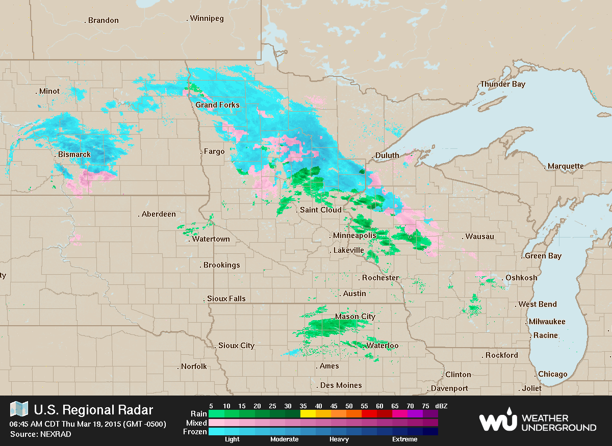
Some light snow mixed with rain was falling over portions of central Minnesota this morning. This precipitation is expected to remain light, with totals of less than a tenth of an inch.
As MPR News meteorologist Paul Huttner has been noting in recent blogs, our neck of the woods could use some moisture going into spring. Since Dec. 1, 2014, Fargo, N.D. has tallied only 1.25 inches of precipitation, which is 1.63 inches below normal.
In the Twin Cities we are running more than inch and three quarters below normal for 2015.


Kentucky and Tennessee have been in a favored region for late winter snow and rain, resulting in well above normal precipitation in the past 30 days.
Support Local News
When breaking news happens, MPR News provides the context you need. Help us meet the significant demands of these newsgathering efforts.

There will be a couple of opportunities for welcome precipitation in the next five days, but amounts are likely to be quite light. Hopefully, southwest Minnesota can be blanketed with a quarter inch of precipitation.

Once again temperatures will be to be above normal this afternoon, although on the coolish side where cloud cover persists in northeast Minnesota. The normal maximum for St. Cloud on this date is 40 degrees.

After a very cold start to the month of March, with two days of subzero readings on March 4-5, the temperatures have been well above normal. As of Wednesday, the temperature for the month is close to 5 degrees above normal for Minneapolis-St. Paul.

Looking at the climatological records for Minneapolis-St. Paul for this date, March 19, I noticed the record high is 79 set in 2012, and the record low is 15 below zero in 1875. There are few dates when you see this large of a spread, 94 degrees between a record maximum and minimum temperatures.
Warmer temperatures, ample sunshine, rather low relative humidity, along with increasing south winds on Friday will enhance the risk of grassland fires, particularly in southwest Minnesota.

The National Oceanic and Atmospheric Administration's Storm Prediction Center is looking for business. A recent post on the center's Facebook page noted the lack of strong thunderstorms in a normally very active month.

Meteorologists noted that the atmosphere should become more frisky as we move into April.
NORMAN, Okla. -- During a month when severe weather typically strikes, this March has been unusually quiet, with no tornado or severe thunderstorm watches issued by NOAA's Storm Prediction Center so far. And, National Weather Service forecasters see no sign of dramatic change for the next week at least.
"We are in uncharted territory with respect to lack of severe weather," said Greg Carbin, SPC's warning coordination meteorologist. "This has never happened in the record of SPC watches dating back to 1970."
Temperatures are expected to cool down as we move into the weekend. We are still keeping up some hope for a precipitation event in the upper Midwest next week.
