Arctic 48 hours, thaw begins Friday
Go Deeper.
Create an account or log in to save stories.
Like this?
Thanks for liking this story! We have added it to a list of your favorite stories.
Cold enough for ya?
Many Minnesotans have had enough of winter's cold at this point in the season. Close your eyes and take a long nap, until Friday afternoon. You'll wake up in a much milder weather pattern.
In the meantime, brace yourself for arctic air for 48 more hours.

Here's the culprit for today's bitter bite in the air. One more arctic high pressure cell rides south from the Arctic Circle. That funny red line over Minnesota Friday? A welcome warm front.
Turn Up Your Support
MPR News helps you turn down the noise and build shared understanding. Turn up your support for this public resource and keep trusted journalism accessible to all.

Meantime we brace for one more sub-zero night tonight across the Upper Midwest.

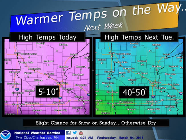
Thaw begins Friday
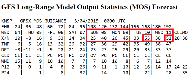
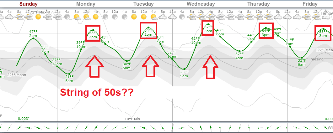
The coming thaw happens in two stages. The first features temps above freezing by Friday and Saturday afternoon. That's a good start. Stage 2 features a much milder gush of Pacific air boosting temps into the 40s, and probably 50s next week.

The European Centre for Medium-Range Weather Forecasts model output below continues to be the most aggressive with the coming thaw. My feeling is this is a bit too aggressive, but it's possible.

Stay tuned on updates for the magnitude and duration of next week's thaw. There are some signs cooler and more typical March-like air may return late next week.
Boston edges closer to snowfall record
A gush of milder air changed snow to rain last night in Boston just as the city was closing in on the all time single season snowfall record.
Meanwhile winter storm warnings are flying for a big swath of states in the central and eastern United States.

Ice and power outages are a concern in the south. Here's the latest video briefing from the Memphis, Tenn., National Weather Service.
https://www.youtube.com/watch?v=CS34o_SKgNE&feature=youtu.be


