Strange Weather: Records, rain to snow, beige Christmas?

Go Deeper.
Create an account or log in to save stories.
Like this?
Thanks for liking this story! We have added it to a list of your favorite stories.
Strange Weather
The past few days have been a little weird for Minnesotans.
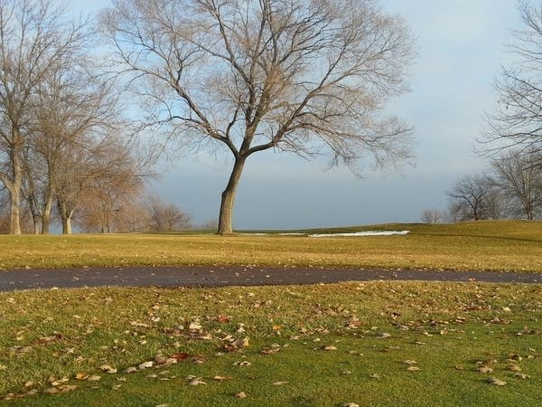
We're not used standing water on top of ice on our usually solidly frozen 10,000 lakes in mid December. Green grass and golfers on a mid-December weekend? That's a little unnerving for many Minnesotans.

Turn Up Your Support
MPR News helps you turn down the noise and build shared understanding. Turn up your support for this public resource and keep trusted journalism accessible to all.
51 degrees - record high at Minneapolis-St. Paul International Airport today at 4:45 a.m.
First Twin Cities record high ever recorded between 4 a.m. and 5 a.m.?
3rd straight December day at or above 50 degrees at the airport
49 degrees - highest dew point ever recorded so late in the year at airport
+4 degrees - December temperatures vs. average through today (pending final numbers today)
And consider the context and perspective on these numbers forwarded to me by my MPR colleague and University of Minnesota climate expert Mark Seeley this morning. Not only was this morning's high of 51 degrees a new record for today, but it may be the first time we've ever recorded a record maximum temp between 4 and 5 am. We also smashed dew point records this weekend.
The 51°F at MSP airport at 4:45 am this morning breaks the record high of 49 °F set on this date in 1923, but more than that I think it is the only time in the Twin Cities climate history that a maximum temperature record has been set between 4:00 and 5:00 am.
Further over the last three days the Twin Cities has set new daily records for highest dewpoints: 44°F on Dec 13th; 48°F on Dec 14th; and 49°F on Dec 15th. The last reading is the highest water vapor content ever measured in the Twin Cities so late in the year.
Mark
Yes, you heard that right. The Twin Cities has never recorded as much water vapor this late in the year as we did today with our 49 degree dew point.
Welcome to another extreme weather event in Minnesota.
Mark and I have talked many times about the three- to four-fold increase in winter rain in Minnesota in recent decades. Today brings another shot of December rain to the Twin Cities metro area and some (more typical) significant snow to the west.

A strong low pressure wave tracks from Kansas City through Des Moines, Iowa, to Milwaukee by tonight. Normally we would be talking about and shoveling several inches of heavy wet mid-December snow in the metro with that storm track. Not this time. Temperatures in the 40s in the lowest mile of the atmosphere overhead delivers mostly rain today, transitioning to a little post cold frontal slush on the back side of the low tonight as it pulls away toward the Great Lakes.

A half inch of rain today in the metro?

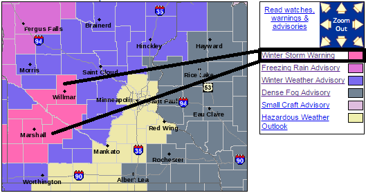
Further west and deeper into sub-freezing air, Winter Storm Warnings remain up today west of the metro for three to six inches of new snow. Expect difficult travel west and north of the metro today.

Winter weather advisories run through Duluth too. Expect wintry travel north on Interstate 35 and along the North Shore today.

A quick glance at the next week shows a return to sunnier, more typical December temperatrures this week as highs return to the 20s. A minor thaw looks likely early next week.

The medium range models continue to hint at the potential for some (light?) snow just as Christmas arrives.
A beige Christmas this year?
Stay tuned.


