Heating up Thursday with spotty storm chances ahead
Temperatures and dew points will creep back up
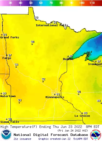
A comfortable early morning will lead quickly to a hot afternoon across much of Minnesota as 90s return to many places. Dew points will also be increasing and we have some spotty storm chances Thursday night into Saturday.
90 degrees and humid air return
I hope you enjoyed our one-day break from the 90s. Much of western and southern Minnesota will see high temperatures again in the low 90s Thursday afternoon. Dew points will climb again into the sticky 60s and even be near 70 for some places Friday.

Friday will be close to 90 though some clouds left over from a few thunderstorms may keep temperatures just below the mark.

Storm chances increase but remain spotty
The chance of storms increases Thursday night into Saturday. The best chance Thursday night and Friday will be in northern Minnesota for some spotty storms; some could drift south. The best chance of storms in the Twin Cities comes Friday night into Saturday as a cool front sweeps across the state.

Create a More Connected Minnesota
MPR News is your trusted resource for the news you need. With your support, MPR News brings accessible, courageous journalism and authentic conversation to everyone - free of paywalls and barriers. Your gift makes a difference.