Sunday rain chances highest to the south; Wednesday soaker?
Fall color update for leaf-peepers
Saturday afternoon was gorgeous!
The Saturday high temp at Minneapolis-St. Paul International Airport was 52 degrees. That’s just two degrees shy of our average Oct. 23 high in the Twin Cities. Highs in the upper 40s to lower 50s were found throughout most of Minnesota and western Wisconsin on Saturday. We had light winds and plenty of sunshine.
Look for some changes on Sunday.
Sunday rain chances highest south
Create a More Connected Minnesota
MPR News is your trusted resource for the news you need. With your support, MPR News brings accessible, courageous journalism and authentic conversation to everyone - free of paywalls and barriers. Your gift makes a difference.
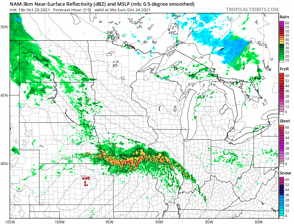
A low pressure system will track across northern Missouri on Sunday, spinning moisture northward. The steadiest rains are expected to fall in Iowa, northern Illinois and parts of southern Wisconsin Sunday and Sunday evening. Far southern Minnesota will see periods of showers Sunday and Sunday evening, especially along and south of I-90. It looks like scattered afternoon/evening showers could spread as far north as Marshall, New Ulm and the southern edge of Twin Cities metro area.
The National Oceanic and Atmospheric Administration’s North American Mesoscale (NAM) forecast model model shows the potential rain pattern Sunday and Sunday evening:
Want a second opinion? NOAA’s High-Resolution Rapid-Refresh (HRRR) model shows a similar rain pattern Sunday and Sunday evening:

You can hear updated weather information for Minnesota and western Wisconsin on the Minnesota Public Radio News network, and you can see updated weather info on the MPR News live weather blog.
Wednesday looks like the rainiest day of the coming work-week, with periods of rain across much of Minnesota and western Wisconsin.
Temperature trends
Sunday highs will range from the 40s to lower 50s:

Sunday will be breezy, with afternoon gusts of 20 mph or higher in some locations:

Plotted wind forecasts are in knots, with 18 knots equal to 20.7 mph.
Back to forecast highs, Twin Cities metro area highs are projected to reach the lower 50s Monday, then mid 50s Tuesday, before returning to the lower 50s Wednesday. Highs in the mid 50s are forecast for Thursday and Friday.
Fall colors
The latest fall color report from the Minnesota Department of Natural Resources shows colors past peak in the dark-red shaded areas of Minnesota:
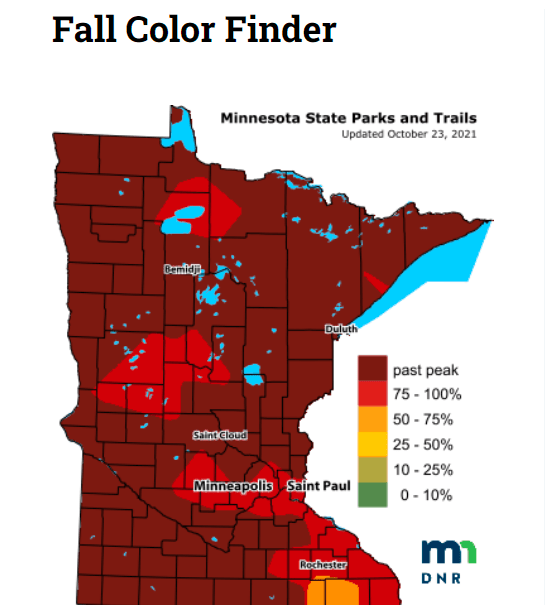
The percentage of changeover to fall colors is between 75 percent and 100 percent in the medium-red shaded areas, including much of the Twin Cities metro area and portions of southeastern Minnesota.
Keep in mind that all deciduous trees are included in the fall color report, not just maples.
Wisconsin fall color info can be found here.
Programming note
You can hear my live weather updates on MPR News at 7:35 a.m., 9:35 a.m. and 4:39 p.m. each Saturday and Sunday.