Rain, thunder and small hail with storms Wednesday
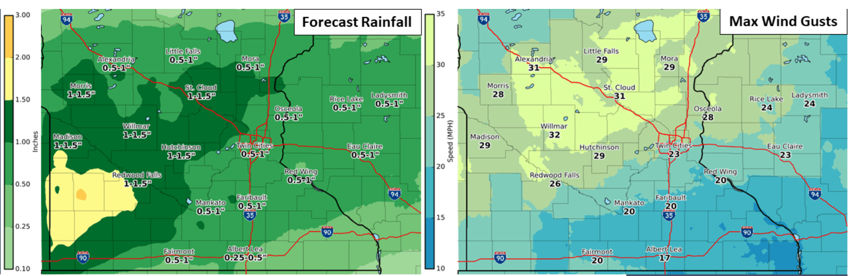
Many areas will pick up rainfall totals of one-half inch to 1 inch
A wrapped-up October low-pressure system is driving areas of rain and thunder across central and southern Minnesota.
Scattered rain and embedded thunderstorms continue to push across Minnesota Wednesday. Some feisty thunderstorms are embedded within the larger rain zone. Pea-sized hail has been reported on the pumpkins with some of the stronger cells, like this scene from Lakeville in the southern Twin Cities suburbs.
The National Oceanic and Atmospheric Administration’s NAM 3 km resolution model tracks the low-pressure system and rain zones across Minnesota into Thursday morning. Most of the thunder cells will move through Wednesday afternoon, with more general showery weather through Wednesday night.

Rainfall totals across central and southern Minnesota will land in the one-half inch to 1 inch range for many of us. There could be some local 1 inch-plus totals favoring southwestern Minnesota.
Marginal risk for southern Minnesota
NOAA’s Storm Prediction Center paints a marginal risk for a few severe storms across southern Minnesota Wednesday.

Frosty again by Friday
A much colder air mass blows in behind Wednesday’s storm system. Highs will hover in the 40s and low 50s the rest of this week.

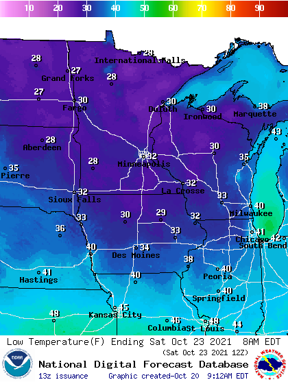
Low temperatures Friday through Sunday mornings will dip below freezing again across much of Minnesota. Lows in the Twin Cities will hover near to just above the freezing mark this weekend.
Create a More Connected Minnesota
MPR News is your trusted resource for the news you need. With your support, MPR News brings accessible, courageous journalism and authentic conversation to everyone - free of paywalls and barriers. Your gift makes a difference.