Frosty suburbs Saturday morning; 70s return by Monday
Big temperature swings are ahead.

It’s that time of year Twin Cities.
Our lingering summery weather pattern has finally given way to more typical fall-like temperatures. And that means chances for frost for southern Minnesota and the Twin Cities.
The coldest temperatures the next few days likely arrive on Saturday morning. The inner Twin Cities urban core inside the Interstate 494/Interstate 694 loop should hover at or above 40 degrees Saturday morning. But the suburbs and much of southern Minnesota will dip into the 30s.
Highs hover near 60 degrees in southern Minnesota Saturday afternoon. Sunday brings the start of milder temperatures. Highs will push back into the mid-60s in the Twin Cities by Sunday afternoon.
Create a More Connected Minnesota
MPR News is your trusted resource for the news you need. With your support, MPR News brings accessible, courageous journalism and authentic conversation to everyone - free of paywalls and barriers. Your gift makes a difference.
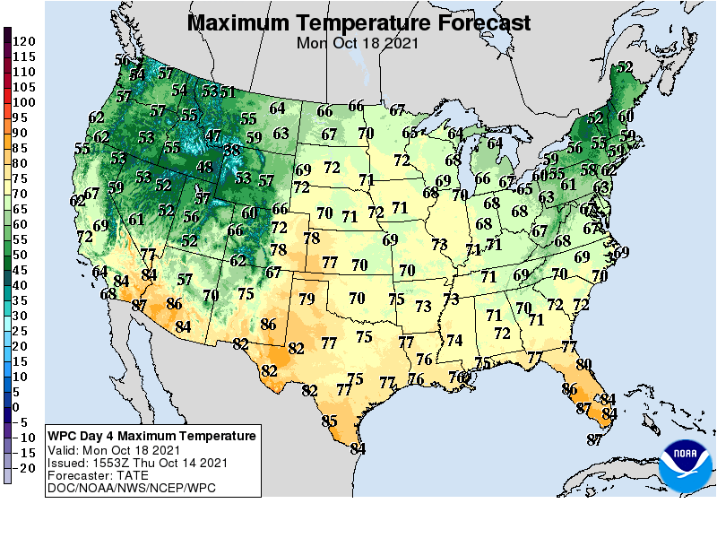
70s return Monday
If Monday is your day off — congratulations. Next Monday brings highs back into the 70s once again.
There are signs of colder air and more frost potential later next week. Lows in the 30s look likely again across most of Minnesota by next Thursday.

Drought improves in western Minnesota
Another soaking rain has helped ease drought in parts of western Minnesota. Here’s the latest drought report: