Summerlike weekend gives way to a September reality check next week
Much colder air on the way late next week?

Get ready for some big changes in our weather picture across Minnesota in the next week.
As I posted earlier today, we begin with thunderstorms and a severe risk across Minnesota Thursday. Friday brings lingering showers in the morning, with a gradual clearing trend from west to east through the afternoon.
Summery weekend ahead
The last weekend of astronomical summer lives up to its name this year. High pressure shifting into the Great Lakes brings a warmer southerly flow to Minnesota. Highs Saturday will reach the 70s across most of the state, with a few spots near 80 late Saturday afternoon.

Sunday brings even warmer air, as the thermal ridge with this warm spell approaches.
Create a More Connected Minnesota
MPR News is your trusted resource for the news you need. With your support, MPR News brings accessible, courageous journalism and authentic conversation to everyone - free of paywalls and barriers. Your gift makes a difference.
Highs will reach the July-like upper 80s and maybe even 90 degrees in parts of southern Minnesota.

Sunday also brings a more humid air mass to Minnesota. Dew points will reach the muggy upper 60s in some areas.

I predict longer lines at your local Dairy Queen Sunday.
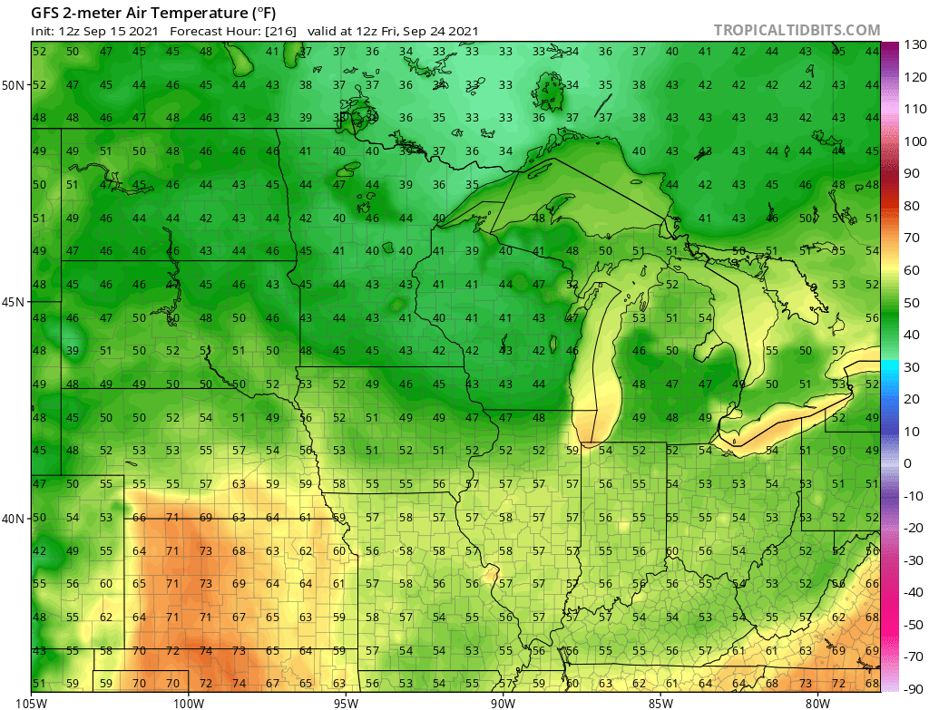
September’s other colder weather shoe
Next week starts warm. But a potent system will shove a cold front through Minnesota late next week. Scattered rain and thunder arrive Tuesday and Wednesday.
By late next week highs will not climb out of the 50s in northern Minnesota, with 50s and 60s in the south.

Some forecast models continue to crank out temperatures in the 30s (and possible frost) up north by late next week.
The longer-range outlook suggests we will likely still see more 70s and possibly 80s in late September.
Stay tuned.