Heat wave diary day 9: 3rd longest streak of 90s on record for Twin Cities
MSP Airport hit 90 degrees for the 9th straight day Friday
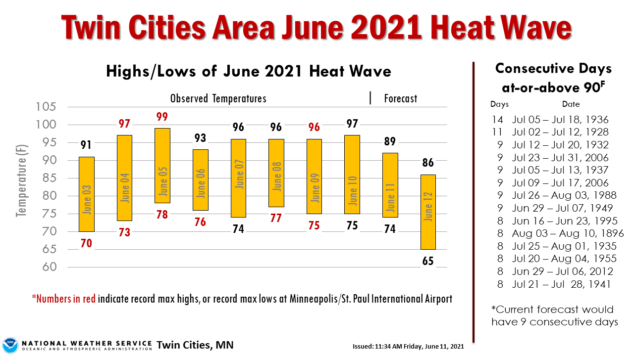
It may be a dubious spot in the record books, but we did it.
Our record early June heat wave reached nine straight days at or above 90 degrees Friday. That’s the third-longest streak of 90 degree days on record in the Twin Cities.
Weekend relief
A cool front blows in a noticeably cooler and much less humid air mass for Saturday. Highs Saturday will reach the upper 80s across much of southern and western Minnesota, with some comfy 70s up north.
Highs returns to the 90s Sunday in southern and western Minnesota with 70s and 80s up north.
Dew points plunge
The biggest change in our inbound air mass is much lower dew points. Watch NOAA’s NAM 3 km resolution model sweep out the dew points near 70 degrees and blow in fresh air mass with dew points in the 50s and 40s overnight into Saturday. The loop below runs from 6 p.m. Friday to noon Saturday.

Temperatures next week run about 5 to 10 degrees cooler than this past week. But it’s still above average.

The average high and low temperatures for the Twin Cities on Monday are 79 and 59 degrees.
Create a More Connected Minnesota
MPR News is your trusted resource for the news you need. With your support, MPR News brings accessible, courageous journalism and authentic conversation to everyone - free of paywalls and barriers. Your gift makes a difference.