Polar plunge: Much colder through Saturday morning
Temperatures closer to reality for January; snowfall likely Saturday
We’re finally getting some respectably cold winter air in Minnesota.
Temperatures and wind chills plunge into Friday morning. Subzero wind chills cover pretty much all of Minnesota Friday morning. Temperatures will bottom out around minus 15 in northern Minnesota. Windchill advisories cover northeast Minnesota.
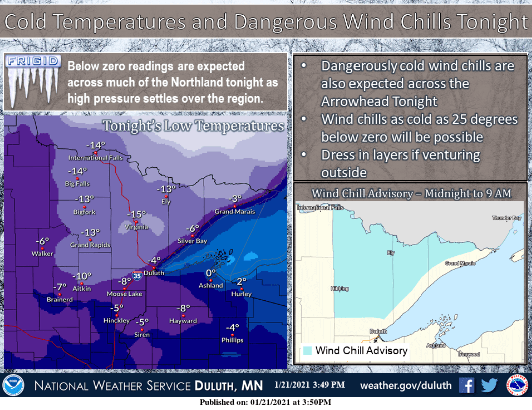
Windchills will dip into the minus 20s in northern Minnesota Friday morning and to around minus 10 in the Twin Cities and southern Minnesota.

Highs hover in the teens across most of Minnesota Friday afternoon, with a few single digits above zero up north.
Create a More Connected Minnesota
MPR News is your trusted resource for the news you need. With your support, MPR News brings accessible, courageous journalism and authentic conversation to everyone - free of paywalls and barriers. Your gift makes a difference.

Milder again late next week?
Temperatures look seasonable over the next week. That means highs in the 20s for most of Minnesota through the weekend into early next week.
But there are already signs of milder Pacific air returning to Minnesota by later next week.

NOAA’s temperature outlooks favor milder than average air again in the one to two-week range.

It’s been hard to keep arctic air around in Minnesota this winter. That trend appears persistent.