Steamy to stormy: Heat and storm risk through Wednesday
Flash floods possible. A break in heat and humidity arrives Friday.
Our steamy summer of 2020 rolls on.
Sunday was the 3rd straight day of 90-degree heat in the Twin Cities and much of southern Minnesota. We’ve now sweated through 8 days at or above 90 degrees in the Twin Cities this year. By week’s end, we’ll be at 9, fast approaching our annual average of 11 days. And we’re not even halfway through summer.
In related news, the Weather Lab AC unit picked the hottest stretch of 2020 so far to quit. Naturally.
Our steamy air mass is capable of scattered severe storms through Wednesday. A break in the heat and humidity blows in Friday on fresher northwest breezes.
Create a More Connected Minnesota
MPR News is your trusted resource for the news you need. With your support, MPR News brings accessible, courageous journalism and authentic conversation to everyone - free of paywalls and barriers. Your gift makes a difference.
Severe risk
Today’s Minnesota air mass features plenty of warmth and moisture with dew points near 70 degrees. That’s a perfect recipe for a few severe cells to pop up.
NOAA’s Storm Prediction Center paints a slight risk for storms packing severe wind and hail from Duluth south this through tonight.
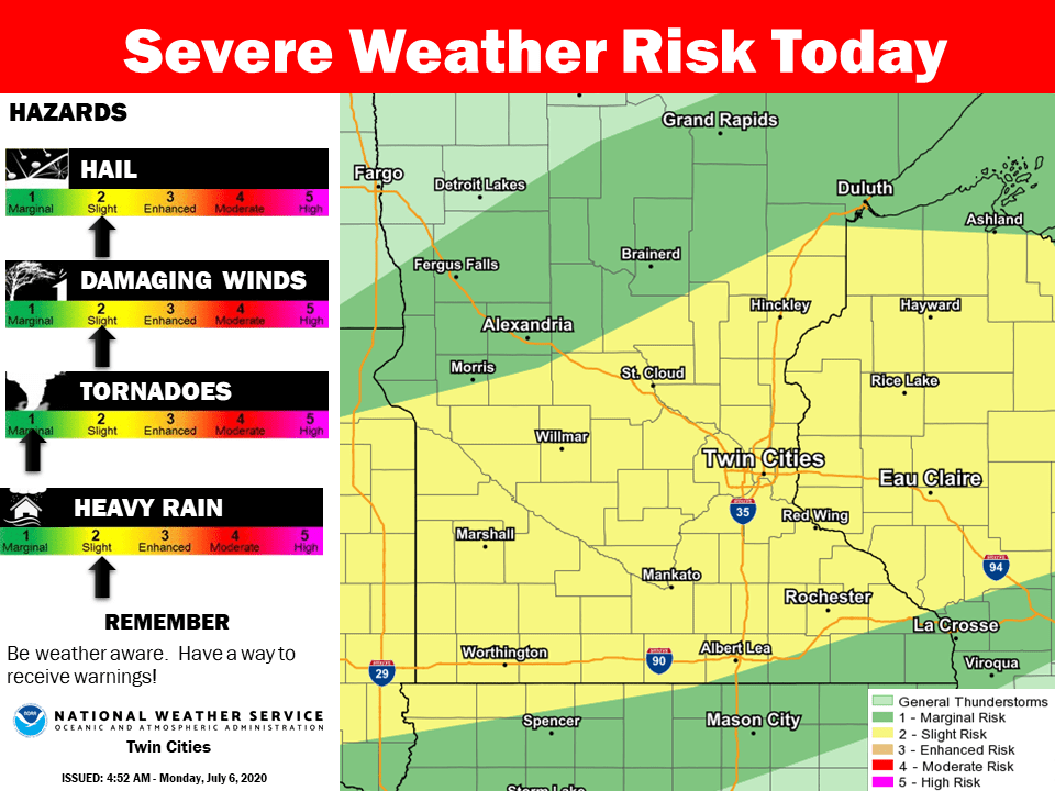
NOAA’s NAM 3 km resolution model favors storms across northeast Minnesota this afternoon, with a few strong to severe storms favoring southern Minnesota late afternoon through tonight.

Flash flood risk
Our tropical air mass features points near 70 degrees. Just like Sunday, that fuel for storms can deliver some locally heavy downpours. The flash flood risk is higher than usual through tonight.

Relief by Friday
Wednesday looks like the hottest day this week. Highs should easily reach the low 90s again across southern and western Minnesota.

Relief arrives with a cool front Friday. We’ll enjoy more bearable highs in the 70s north to low 80s in the Twin Cities and southern Minnesota.
Stay cool and keep an eye out for storms through tonight. Get the latest with my live weather chats at 4:48 and 5:48 on MPR News. See up to the minute watches, warnings, and updates @MPRWeather on twitter and on the MPR live weather blog.