Zeroing in on snow and near-record cold next week
Plowable snow Monday, then subzero temps next week

It’s the first weekend in December. And how did that happen exactly?
Our weekend weather looks docile across Minnesota. Next week looks more like a winter weather obstacle course.
Weather changes next week will make this the most challenging week of winter so far. An Alberta clipper brings snow Monday. Then the season’s coldest air mass so far brings subzero temps to all of Minnesota. And we may set some records for cold next week.
Here’s my latest read on the forecast model trends and the sequence of weather events next week.
Create a More Connected Minnesota
MPR News is your trusted resource for the news you need. With your support, MPR News brings accessible, courageous journalism and authentic conversation to everyone - free of paywalls and barriers. Your gift makes a difference.
Monday snow
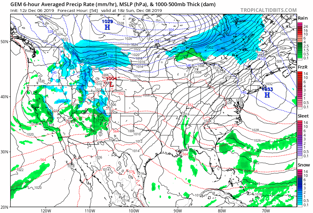
Monday’s system looks like sort of a hybrid Alberta clipper and Panhandle hook. The upper-air energy and cold air blow in from Alberta. The surface low dips into the Oklahoma Panhandle region then hooks northeast toward the Great Lakes.
The National Oceanic and Atmospheric Administration’s Global Forecast System model paints the big-picture trends.
Snow timing: Brutal Monday morning rush hour?
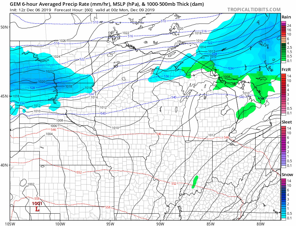
The timing on snow looks bad for Monday morning’s rush hours. Snow crosses the Dakotas Sunday. Most models push snow into western Minnesota Sunday evening and into the Twin Cities by midnight.
The heaviest burst of snow for the Twin Cities favors the morning hours Monday. This Canadian model solution on snowfall timing and coverage Monday looks reasonable to me.
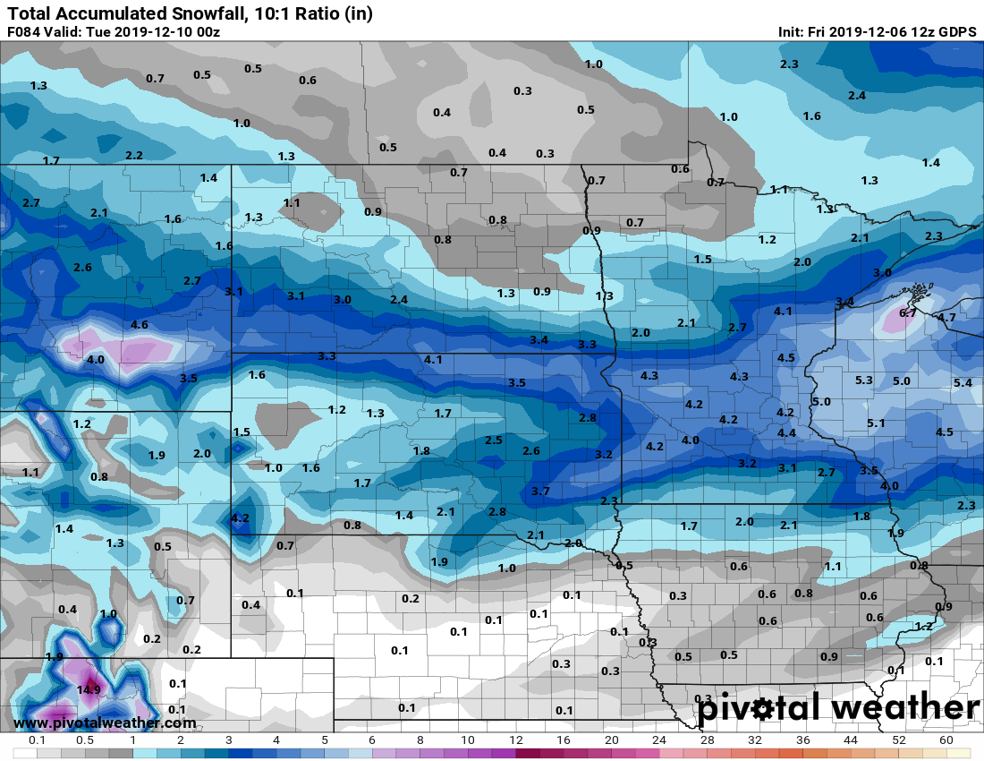
Plowable
Snow ends from west to east late Monday.
Most forecast models favor a swath of 2 to 5 inches across a good chunk of Minnesota. If the clipper is productive or slows down, we could see some more than 6-inch totals.
This Canadian model snowfall output seems like a good early projection.
Arctic outbreak
The season’s coldest air mass so far blows in behind Monday’s snow. Temperatures are in the minus 30s and minus 40s Friday in the Yukon and Alaska interior. That air mass will modify some as it makes the trip south to Minnesota.
The latest guidance backs off just a bit on the magnitude of cold by Wednesday morning. The European Centre for Medium-Range Weather Forecasts model suggests low temperatures around minus 10 in the Twin Cities, with temps closer to minus 20 up north.
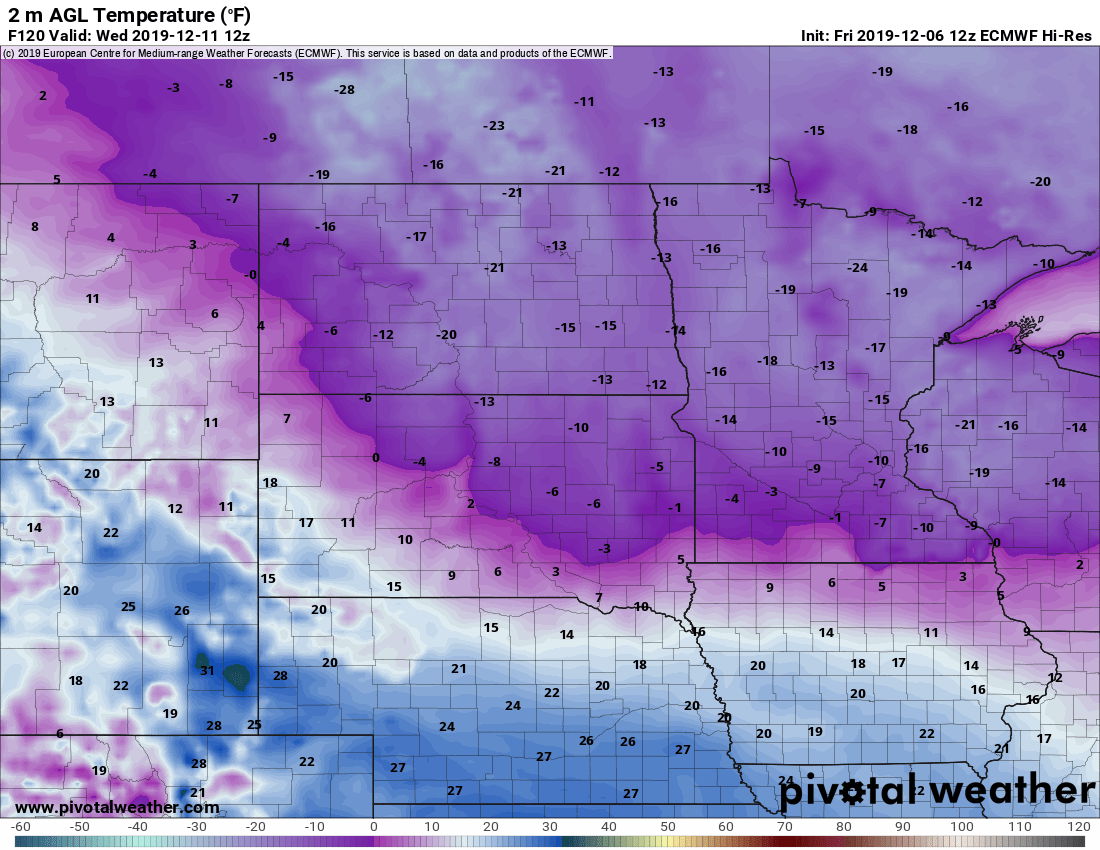
The record low for the Twin Cities next Wednesday is minus 14 degrees at the Minneapolis-St. Paul International Airport.
Stay tuned for forecast updates and possible changes through the weekend!